Tuesday, April 17, 2007

Pushing for Grass Valley Jumps

This afternoon, I made a very brief presentation to the Grass Valley Parks and Recreation Commission about implementing a bike skills facility on city property. This facility would be comprised of dirt jumps, a pump track, obstacles and more. Again, the commissioners were receptive and one mentioned her intention to check out the new bike skill facility in Folsom at Cummings Park. They asked a few questions about maintenance and security of such an area, but said nothing indicated that they are opposed to the project.

As is often the case with new trails, this will be a classic case of slow progress toward a fantastic final goal. I plan to remain persistent and continue to get our ducks in a row until opportunity presents itself. I am convinced that ultimately, Grass Valley will have a sweet bike skills park.

Thursday, April 12, 2007

Osborne Hill Trails Threatened - Help Save Local Trail Access!

Developers have planned to implement a high density, out-of-town, expensive home development atop Osborne Hill near Empire Mine. As many of you know, this area is packed with outstanding singletrack that has been used for decades by cyclists, equestrians and hikers alike. Current plans for this development would obliterate much of this trail network with disregard for existing usage.

State Parks has expressed interest in acquiring the property and annexing it to Empire Mine Historic State Park. There are pending grant applications supported by the Nevada County BOS and the Grass Valley City Council that would make this annexation a reality. Trail users and the community would be best served by this approach, instead of another high end development far from town that shows no regard for existing trails.

WHAT YOU CAN DO:

Nevada County is accepting public comment on this proposed development. Please comment by APRIL 23 using a version of the sample letter below or your own tailored message:

++++++++++++++++++++++++++++

Tod Herman
Nevada County Planning Department
950 Maidu Avenue
Nevada City, CA 95959

Dear Mr. Herman:

This letter is in regards to the proposed Osborne Hill Project. As an area resident and trail user, I am very concerned about this proposal for the following reasons:

- The proposal does not accommodate or preserve existing trails or trail access. This area includes an extensive network of publicly used trails used by the community for many years.

- The proposal involves extensive grading and vegetation removal, all of which will negatively impact these trails. The plans do not address how existing trails will avoid damage from this disruptive activity.

- The proposal involves extensive construction of roads and buildings including an extensive sewage treatment field. Again, such construction will either negatively impact or completely destroy existing trails. Such impact is not addressed in the application.

- The proposal does not address if existing public trail access will be preserved in the development. Such trails should continue to be acknowledged and supported by any such proposal.

In conclusion, this application is incomplete until it fully addresses these issues. I urge the County not to accept the application until the project is sharply reduced or altered so as to accommodate public trail access.


Truly,
YOUR NAME HERE

Wednesday, April 04, 2007

Help Build the Rock Creek Trail

The Gold Country Trails Council will be hosting a Rock Creek Trail Work Day on Sunday, April 29, 9 a.m. - 1 p.m. From the GCTC:

Bring: Loppers, gloves, shovels, hand saws, drinking water and snacks. Plan on wearing the Forest Service required "uniform" (long pants, long sleeve shirt and closed toe shoes).

Why: To complete the construction of the Rock Creek Trail that was started last fall. And to have a fun time working outdoors in the beautiful forest with your fellow club members.

Directions to Rock Creek Nature Trail Head: Take Highway 20 east out of Nevada City towards Reno. Approximately 6-7 miles out of Nevada City, turn left on Forest Conservation Camp Rd. Go about 1 mile and look for a dirt/gravel road on the left leading towards the Nature Trail. Travel down this dirt road to the bottom where the Nature Trail Parking Lot is located."

Wednesday, March 28, 2007

Diamond Arrow Trail Progress

Earlier this week, Bill Haire of the Nevada County Land Trust, John Rapphahn of the BLM and I scouted a route for the upper (southern) section of the forthcoming Diamond Arrow Trail. You can view a track of the route we flagged:

View upper route in Google Maps
View upper route in Google Earth

One important thing I learned on this expedition is that it may be possible to keep the entire trail on BLM property, which would make planning and construction much simpler. Originally, I had thought that the trail would have to cross the Diamond Arrow property.

This project has long been dear to my heart, as I see this trail as a great addition to the South Yuba trail system. It seems that there is some momentum now to move this project along. The BLM may have some resources to conduct the necessary environmental assessment this year. Once that is in place, we can begin construction.

The terrain that this trail will traverse is similar to other areas near Round Mountain. Lots of nice views, poison oak, decomposed granite and steep canyon slopes.
Auburn Alert

IMBA State Rep Jim Haagen-Smit passes this along:

"ALERT: Auburn State Recreation Area Update

Mountain bikers should be aware of two issues concerning riding
opportunities in the Auburn State Recreation Area. First, State Parks is drafting a feasibility study regarding the Auburn to Cool Trail. Second, the management plan for the entire ASRA is being updated. It is important the mountain bike community be at the table. That's you!

Regarding the AtoC trail, it is general consensus that the current trail alignment is too steep and not all that fun. Additionally, the current river crossing has gone away now that the river is being restored into its channel, so agencies are reviewing crossing options. What would you like to see? A big expensive new bridge? A seasonal crossing? Use existing bridges, such as the Mountain Quarries Bridge (currently closed to bikes) or Highway 49, with new well-designed, sustainable trails between Auburn and Cool. Take a moment to send in a quick comment to:

Auburn to Cool Trail Crossing Study
Attn: Jennifer Rogers
c/o Jones & Stokes
2600 V Street
Sacramento, CA 95818
Comment deadline: April 15, 2007.

Next, be a part of the update process for the management plan. Email State Parks to let them know you would like to be on the mailing list. Small stakeholders meetings last Spring and this April are including mountain bikers, as well as equestrians, hikers, etc. Based on comments received, a draft plan will be issued and public hearings will be held. Please be prepared to review the plan and attend the hearings – FATRAC will post details. To get on the mailing list, email: jmiche@parks.ca.gov

For more information on the Auburn State Recreation Area, go to www.parks.ca.gov.

Contact: Cathy Haagen-Smit at (916) 663-4626."

Monday, March 19, 2007

New Space for Trails Near Auburn

The Sac Bee ran a story on Saturday indicating that Placer County intends to acquire over 600 acres of open space near the Hidden Falls Regional Park near Auburn. The plan is to use this land as an additional location of trails and recreation. View the existing Hidden Falls Trail map (PDF).

I have not visited the Hidden Falls park yet, but I hear that it is ripe with trail opportunities and possibilities. A big thank you to Placer County for taking on this initiative! And here is another story about open space acquisition near Donner.

Thursday, March 15, 2007

Auburn to Cool Trail Public Meeting

From California Department of Parks and Recreation:

"Please join us to learn more about the Auburn to Cool Trail Crossing Feasibility Study! The California Department of Parks and Recreation is exploring options to provide a trail crossing of the North Fork of the American River for the Auburn to Cool Trail. We would like your input on crossing options, including potential bridge types and locations.

What: Public meeting
When: Tuesday, March 27 at 6 pm
Where: Canyon View Community Center, Foothills Room, 471 Maidu Drive, Auburn, CA

Project Background: The Auburn to Cool Trail is a multi-use recreational trail route between Auburn and Cool. The Auburn to Cool Trail is located within the Auburn State Recreation Area and crosses the reach of the North Fork American River that has been dewatered to allow for construction of the Auburn Dam. The Bureau of Reclamation and the Placer County Water Agency are working together to build a new Pump Station and to restore the North Fork of the American River to its historic channel. When complete, the restoration of the river will allow for all beneficial uses of the river in what is now the dewatered channel, including recreation, fisheries and other in-stream uses. As a result of this project the North Fork of the American River will divide the Auburn to Cool Trail. The California Department of Parks and Recreation is preparing a study to assess the feasibility of various options to provide a trail crossing
of the river.

We want to hear from you. This meeting will allow residents, stakeholders and interested parties to learn more about the potential Auburn to Cool Trail crossing project and to provide input on the potential crossing options and locations. Please join us!

For more information about the meeting, please contact Jennifer Rogers at (916) 737-3000, ext. 3326."

Tuesday, March 13, 2007

GCTC Spenceville Ride

Trail Boss Mark Hicks invites you to attend the upcoming equestrian Spenceville Ride!

NEW Date: Saturday, March 24, 2007
Time: Ride out at 10 a.m.

Directions: Take Highway 20 west out of Grass Valley; turn left on Smartsville Road heading towards Beale AFB; take left fork; turn left on Waldo Road; pass shooting range; cross Waldo Bridge; bear left 4 miles to staging area on left.

Questions or planning on attending the ride? Please RSVP/contact Mark Hicks at 530-268-0799 or e-mail lislhix@jps.net. Happy Trails!
Fund Raiser for NorCal High School Mountain Bike Racing League

From Jason Moeschler:

"The NorCal High School Mountain Bike Racing League is Pleased to announce the World Premier Tour of the Mountain Bike Movie 24 Solo. This is a benefit for the NorCal High School Mountain Bike Racing League.

The movie will be playing in five locations throughout Northern California, including a stop at our very own Del Oro Theater, in Grass Valley.

By the looks of the trailer, the movie is going to be a good one. It will be a great evening to get together with the other local bike riders, and watch a good riding flick, while helping out the NorCal League.

The Movie will be playing on April 18th at 7:30pm at Del Oro in Grass Valley. For more information, to buy tickets, or to view the movie trailer, go to http://www.norcalmtb.org/."
Miners Indie Mountain Bike Team Article

There is another article in today's Union about the independent Miner's high school mountain bike team. It is very encouraging to see how well this team and the entire league has fared since they launched. Team practice rides always involve large number of kids and many members of SERT join in to help coach and mentor these you racers.

What a great way to focus your energy and time as a high school student. Way to go Miners!

Wednesday, March 07, 2007

Bicycle Master Plan Coming to Nevada County

Nevada County will conduct a bicycle master plan workshop on March 20, 6:30-8pm at Grass Valley City Hall. I also encourage ALL of you who ride a bicycle on dirt or pavement to attend this short meeting. If you ride the road, it is a great opportunity to ask for better riding conditions, bicycle lanes, etc. If you prefer the dirt, this represents a great chance to speak up for new trails as transportation corridors.

From Mike Woodman, Transportation Planner, Nevada County Transportation Commission:

"The Bicycle Master Plan is coming along well. Alta Planning + Design have been working on the mapping in preparation for public workshops in eastern and western Nevada County.
I have provided flyers to the bicycle shops and will be contacting BONC and the Sierra Express Bicycle Club as well. Also, a bicycle user survey is posted on the Nevada County Transportation Commission website at www.nctc.ca.gov.

The survey can be found by clicking on the "Poll" button on the bottom left of the homepage. The survey is in Adobe Acrobat format and is setup to allow the user to check boxes and fill in responses. Once it is complete it can be saved to the users computer and emailed in to me at mwoodman@nccn.net or printed out and mailed or faxed.

Hope to see you at the workshop on March 20th."

Thursday, March 01, 2007

New and Improved Trails Planned

The USFS is planning to improve and add trails near Downieville, Grouse Ridge and Highway 20. To this end, they have published public scoping documents that describe these exciting new updates to our trail inventory.

The first three of the following documents have maps that describe the planned work. I suggest that you take a quick look at these documents and pass along your support to Tahoe National Forest staff:

Monday, February 26, 2007

What Do You Think?

Traditionally, trail building and improvement projects have been based on ideas from land management agencies and club leaders. But what trail projects do you think need our attention?

Use the comment feature of this blog to speak out about deserving trail work projects in and near Nevada County. Maybe we can address them in an upcoming trail work day or two.

Monday, February 19, 2007

Big Bullard's Day

If you were to ride Bullard's Bar sometime just after the next rainfall, you would probably experience the best trail conditions that system has ever seen.

Why? Because on Sunday, some 40+ BONC and SBTS volunteers joined forces to put in a complete set of trail enhancements. Check out some photos (and let me know if you have any others). The trailwork included:
  • Lopping and trimming overgrowth on the whole trail system
  • Improving drainage features on a number of trails, including backsloping
  • Cutting a new short connector trail between 7-Ball and 8-Ball Trails and sign installation
  • Removing tree stumps in various locations
  • Installation of culverts on Bullard's Bar Trail
Thank you to everyone who participated, including the Tahoe National Forest staff.

Wednesday, February 14, 2007

Miners Earn an IMBA Grant

Today's Union has an article about the successful IMBA grant application put in by the Nevada Miners Indie high school mountain bike team. Way to go!

According to team coach Debra Little, the club hopes to use the money to buy some trail work tools and to improve the trail around the old Nevada City airport. Best of of all, it gives an incentive to these members of the next generation of cyclists to become involved in trailwork and mountain bike advocacy.

Of course the high school team already did a great job of trailwork last fall on the Scott's Flat Trail.

Monday, February 12, 2007

Tread Lightly

According to The Union, Nevada County received some five (count 'em) inches of rain over the weekend. So this means that our beloved trails are saturated, mucky and very vulnerable to damage.

Please consider avoiding the trails until things dry out a bit in a day or two. Personally, I plan on riding the road until Friday. I just hate to think that I am creating on trails ruts that will stick around for months or beyond.

Friday, February 09, 2007

Trail Daze @ Bullard's

As mentioned in a previous post, BONC will join forces with SBTS for a big weekend of riding, camping, more riding and quality trailwork on the Bullard's Bar trail system on 2/16-2/18. Here is a schedule of events:

Camping
Free camping will be provided Fri/Sat/Sun night at the Dark Day Campground at Bullards Bar by RSVP ONLY. You must let us know if you want a site.

Sunday
SBTS crew to meet at the Dark Day Campground at 9AM.
BONC crew meets at the Camptonville Ranger Station at 10AM.
SBTS to provide lunch fixins for Sunday work day
SBTS Sponsors to provide swag and beer

*Bring your own water for the entire event - water is turned off at the campground for the winter *

Rides
Saturday ride groups meet at 12 Noon at Dark Day Boat Ramp. There will be rides for varying skill and fitness levels. Sunday after-work ride planned for 2:30 or 3:00.

Wednesday, February 07, 2007

Horse Post

Get it (the bad pun above)? This blog is more bicycle-centric than I would like, so here goes my first in a series of equestrian rides listings. From the GCTC:

"Gold Country Trails Council's 1st Ride of the New Year!

Trail Boss Mark Hicks invites you to attend the upcoming Spenceville Ride!

Date: Saturday, February 10, 2007
Time: Ride out at 10 a.m.
Directions: Take Highway 20 west out of Grass Valley; turn left on Smartsville Road heading towards Beale AFB; take left fork; turn left on Waldo Road; pass shooting range; cross Waldo Bridge; bear left 4 miles to staging area on left.

Questions or planning on attending the ride?
Please RSVP/contact Mark Hicks at 530-268-0799 or e-mail lislhix at jps dot net."
Winter Returns

Of course, it had to end. The ridiculous streak of sunny, dry days wraps up this week with lots and lots of rain predicted. I will miss the endless opportunities to ride the last month brought, but I know the trails very much need the moisture. Some of the conditions out there have started to resemble those of early summer, as I've seen plenty of dust and even some duff in places.

My partner recently got me a pair of Lake winter mountain bike shoes. I will probably fit my road bike with compatible cleats and see how these work on both bikes. I've worked really hard to improve my fitness this winter and would hate to start missing too many rides due to weather.

Tuesday, January 30, 2007

Rattlesnake Trailbuilding Continues

The Nevada County Land Trust will be working on a trail along Rattlesnake Creek this Saturday (2/3) from 9:00 a.m. until 12:00 noon. You are invited to come out and help build a section of the trail. The setting is beautiful with large ponderosa pines, cedar and oaks, and Rattlesnake Creek below. The trail we are building will utilize an abandoned ditch, paralleling the creek for much of the distance. Tools will be provided by the Land Trust; however if you have a trailbuilding tool, bring it so we don't run out of tools. Work will consist of clearing debris from the abandoned ditch grade and grubbing out small trees, brush and roots to make a smooth trail bed.

Meet at Bob Goar's house at 14676 Highland Drive (phone number is 477-5050). Highland Drive is off of Rattlesnake Road, it meets Rattlesnake Road at two points, you take the second Highland Drive if traveling from Highway 174. From Cedar Ridge, travel south on 174 to Rattlesnake Road, then 1.4 miles down Rattlesnake to Highland, left on Highland to the first house on the left (just across the creek). We will walk from there to the work site, across Rattlesnake Road in the Rattlesnake Ridge Subdivision.

Please call if you need any additional information. A response is appreciated if you plan to help out, so that we have an idea about how many tools are needed. Call for more information: 272-5311

Monday, January 29, 2007

Reschedule of BONC Party

Due to a conflict with Jim Rodgers' 50th birthday party, we need to reschedule our BONC pot luck to FRIDAY, February 9th at 7PM. See you there!

+++++++++++++++++++++++++++++

Ken Ebi will host the next BONC potluck on Friday, February 9 at 7PM (note the time!).

Please bring your favorite dish. Some folks like it when you label your dish vegetarian/vegan. As usual, the BONC meeting at this party will last *no longer than one hour*, hopefully less.

PARTY LOCATION: Ensemble Designs at 870 Gold Flat Rd., near Gold Flat Rd. & Railroad Ave. in Nevada City. There's a sign on Gold Flat that reads "Racine Properties", the entrance to Ensemble is along the right side of the building as you drive in from Gold Flat.

MAP and DIRECTIONS: http://tinyurl.com/2fy7da
Freaky Winter

What strange winter it has been recently. Take the following:

Auburn trails are dusty. Not all trails are this dry; in fact most are perfect. But in those sections that see a lot of sun exposure, you can see dust follow feet, hoofs and tires as they travel the trails. In January.

Up near Grouse Ridge, there is very little snow. You can drive in all the way up Bowman Lake Road to the turn off for Carr/Feely Lakes and beyond. This is at least 5500' elevation without significant snow. In January.

I guess I am happy about this in a myopic, self centered way, but I am concerned that if this continues, this will be a rough winter on the state. But then again, last March was crazy wet, so we will have to wait and see.

Thursday, January 25, 2007

Western States Trailwork

Volunteers are needed to work on the trail from Cool to the "No Hands Bridge" Sunday, January 28th

Meet in Cool behind the Fire Station at 8 a.m. If anyone is interested in helping, please call 530-269-3018.
BONC Party February 10th

Ken Ebi will host the next BONC potluck on Saturday, February 10 at 6PM (note the time!).

Please bring your favorite dish. Some folks like it when you label your dish vegetarian/vegan. As usual, the BONC meeting at this party will last *no longer than one hour*, hopefully less.

PARTY LOCATION: Ensemble Designs at 870 Gold Flat Rd., near Gold Flat Rd. & Railroad Ave. in Nevada City. There's a sign on Gold Flat that reads "Racine Properties", the entrance to Ensemble is along the right side of the building as you drive in from Gold Flat.

MAP and DIRECTIONS: http://tinyurl.com/2fy7da

Tuesday, January 23, 2007

Official: All Empire Trail Closures are Temporary

I just spoke with Ron Munson of State Parks. These are definitely NOT permanent closures. He said that Conlon Mine rail may be closed longer than others though due to its proximity to Prescott Mine and hazardous materials from that shaft.

Read the press release.
Trail Closures at Empire Mine: Temporary or Permanent?

According to this press release from CA State Parks, managers of Empire Mine will close some trails in the park on a temporary basis. But according to one of the workers at the park who was erecting a fence across the entrance to Conlon Trail (see map), this particular trail closure is permanent.

So what is the deal? The trails affected at Empire essentially includes all the singletrack in the park. Was this worker misinformed? Before I sound the alarm, I will try to get the story straight from Ron Munson (superintendent of Empire Mine) and post the real story here. Of course, trail enthusiasts will want to watch this closely.

Monday, January 22, 2007

Riding the Divide

Today, my friend Steve and I and I embarked on an epic ride on Western States and others trails at the Foresthill OHV area east of Foresthill, CA. We started at the China Wall OHV staging area and banged out a ride that was just under 6 hours (~5 hours of ride time on the Polar!). The ride featured two incredible descents into El Dorado Canyon (Trail 5 and Western States Trail). I can't really describe how fun and spectacular these drops were, especially the WST descent. Endless, narrow, technical challenging singletrack that offered stunning views of the American River watershed.

So why in the world don't more mountain bikers flock to these great trails? Well, once you get to the bottom of each descent, you have to complete a death march/hike a bike out. The climbs involved at least 45 minutes of walking each. Think Halls Ranch near Downieville, but much steeper. Times two. Yeah... ouch. Steve and I decided to have a good attitude about this and enjoy the scenery and the workout. But it was a long trek up each climb.

The OHV trails we hit were really fun and challenging. Very fast and technical. We saw a few motos, two equestrians and zero other mountain bikers. I should also note that this ride would never be accessible in the middle of a typical January, but there is very little snow throughout the Sierra this winter thus far. We did encounter some ice, but very little snow.

Friday, January 19, 2007

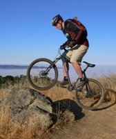
Another Beginner Mountain Bike Opportunity

Dawrin Leek leads a ride for beginners this Saturday. According to Darwin:

What: Beginner / Intermediate mountain bike ride. Saturday 1-20-2007

Where: Meet @ Empire Professional Building, Back, Body & Beyond / Chiropractic +, 605 South Auburn Street, Front Parking lot. Grass Valley, CA (Corner of Empire & South Auburn Streets)

Time: Arrive @ 9:30-9:45 am / Leave promptly @ 10:00 am.

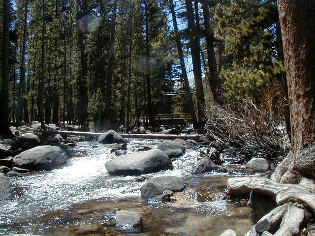
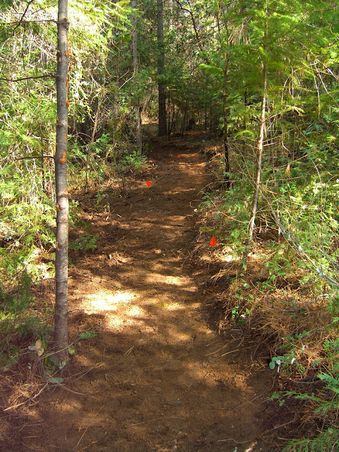
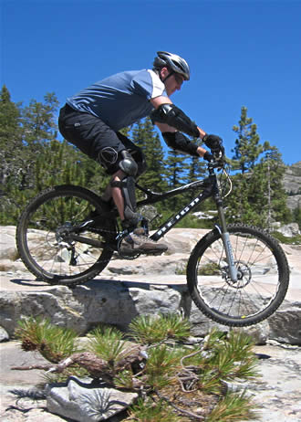
Details: Empire mine state park, fire roads, single track, hills, etc. Ride will be at beginner / intermediate level / those more advanced that know the park are invited to assist/ encourage others, or go @ your own pace.

Further Details?? Contact: Darwin S. Leek, D.C.@ (530) -273-8082 (press 6 to leave message)

What to bring: Weather appropriate clothing. Recommendations: (2 layers lycra / with nylon shell-vest is best) Full fingered gloves, Wool socks, non-slip comfortable cycling appropriate shoes. H20: Water bottle, or hydration pack. Spare tube / pump / recommended. Bike helmet * REQUIRED...NO HELMET= NO RIDE. Oh yeah... Don't forget to bring your fat-tire... not the beer... the bike....( :

I practice the "No Rider Left Behind" Rule....Will wait at turns...tops of hills for those that are not yet able to keep up...This is designed to be a fun ride for all.

Not to put a damper on things, or discourage participation, but this probably does need to be said: While generally a safe and fun sport...due to the strenuous physical nature & terrain involved in Mountain Biking, as in other such sporting / recreational endeavors: MINOR TO SEVERE INJURY / BRUISES / FRACTURES / DISLOCATIONS, OR DEATH CAN OCCUR...all participants do so @ their own risk & take full responsibility for their own state of health /actions / equipment / abilities / choices. Minor children must be accompanied by a responsible parent / guardian. In other words I am doing this as a way to introduce people to a generally healthful & fun recreational activity in our community, so don't get maimed, wounded, hurt, or dead & sue me : ( , or I will have to find something else to do with my Saturday mornings. ( : !!!

Wednesday, January 17, 2007

So Whatever Happened to the Diamond Arrow Trail Anyway?

Good question. Those of you who recall know that the Diamond Arrow Trail was a proposal to construct a trail from the Diamond Arrow Christian Conference Center down into the South Yuba Canyon where it would connect to the South Yuba Trail just downstream from Edwards Crossing. View a map of the proposed route here.

The Diamond Arrow Trail proposal won the support of the South Yuba Management Plan. This plan was the result of many public volunteer hours and countless input meetings. The plan wrapped up in 2005.

But the planners (USFS, State Parks and the BLM) needed money to implement this management plan. Funding of this would pay for the environmental assessment needed before we could construct the trail. Today, I called BLM and State Parks only to find that a recent Prop 50 grant application for the plan was denied. These officials had no other news about possible funding. Even the plan's hotline and website has no updated information.

I would hate to think that all of us who donated a lot of time to these meetings and trail planning did so in vain. When will the plan be financed? When can we see the management plan implemented? The public wants and deserves to know.
More Trail Building on Rattlesnake

From the Nevada County Land Trust:

"Are you tired of staying inside and out of the cold? This Saturday, the Nevada County Land Trust is providing two opportunities to work outdoors: 1) Rattlesnake Ridge trail construction and (2.) Salter Property cleanup.

Trail Construction starts at 9:00 a.m., meet at Bob Goar's house at 14676 Highland Drive. We will be continuing the trail construction we started in December.

Cleanup at the Salter Property starts at 9:30 a.m., work til noon.
The property is located at 10910 Bitney Springs Road. Work consists of cleaning up the property (placing junk in a dumpster) so that it will
be easier to sell. The funds will go toward developing a dog park for the community.

Please give me a call if you want any additional information.

Bill Haire
Trails Coordinator 272-5994"

Monday, January 08, 2007

Beauty of Auburn Trails

We rode a shortish Auburn loop (Google Earth file) yesterday (Clementine > Connector > back on Connector > Fuel Break > Culvert > Confluence). The trails were in great condition. Some recent work was done on the Connector Trail which allowed water to drain off the trail at sections where otherwise mud would collect. A big thank you to FATRAC and others who keep these trails in top shape.

The Connector Trail has matured into a terrific route. It is a blast to ride, features a sustainable design and does well in all months of the year. The builders of this trail should be proud of what they've created and all of us should be grateful.

Yesterday, I was struck by the beauty of some of the Auburn trails and the accompanying scenery. For example, just the short section of singletrack near the beginning (bottom) of Clementine is just gorgeous. To see what I mean, visit this web album of our ride.

Sunday, January 07, 2007

Strange Conditions

Trail conditions continue to be very bizarre this winter. There is so much frost and recent hail on or in the ground that often the trail beds seem either very crusty with ice or very, very wet.

I rode the section of the South Yuba Trail from Edwards to Round Mountain yesterday and it was rather dicey. As you may know, that section is already somewhat hazardous, but with the ice it was especially scary. I took my time, as I was riding alone and it was only an hour before dark; if I had a mishap out there, I would be in deep, deep trouble. But at least I did not see any motos out there.

I don't have any stats to back this up, but it seems that thus far, it is very cold this season.

Friday, January 05, 2007

Beginner Mountain Bike Ride - Saturday 1/6

"Beginner Mountain Bike Ride:
When: Saturday 1-6-2007
Where: Meet @ Empire Professional Building.
605 South Auburn Street, Ste: D, Grass Valley, CA
Chiropractic + /Back, Body & Beyond.
Corner of Empire & South Auburn Street (Front Parking Lot)

530-273-8082 (press 6 to leave message)
Meeting Time: 9:45 AM to check Bikes/ Equipment
Leave @ 10:00 AM.

Ride: Empire Mine Loop Service Roads, Single Track, 1-2 hours.

Bring: Bike, Spare Tube, Air-Pump, H20
(Bottle in Cage on bike, or hydration pack).

Temperature appropriate clothing (2-3 layers) 2 layers lycra with nylon shell is best... Full fingered gloves, helmet. (No helmet-No Ride)

Hope to see you there, Darwin S. Leek, D.C."

Thursday, January 04, 2007

Motos Tear Up Round Mountain

While riding Round Mountain a few days ago, I yet again encountered motorcycles illegally riding non-motorized trails. This time it was the Up-and-Over Trail near Trailhead Road. These people roared off before I could confront them. Sigh. Like many others, I am becoming really tired of seeing shredded trailbeds due to illegal moto usage on local trails.

As part of our spring trailwork, I would like to propose to the BLM that BONC erect some kind of moto obstacles and signage on these trails on and near Round Mountain. I realize that such actions are not going to stop the least considerate moto heads, but it might deter others. Right now, it is too easy for these people to assume that it is OK to go off and tear up sensitive trailbeds.

Wednesday, December 27, 2006

Deluge

OK, first it was frost. Now it is the endless days of rain. You see, I knew this was coming. It comes every year, "it" being the long spell of cold rain days that keep me off the trails until I become annoyed and restless. This year it seems particularly frustrating, as I have been very focused on achieving a high level of fitness.

Sure, I could use a trainer or go to the gym. But those things are B-O-R-I-N-G. One of the wonderful things about mountain biking is that it is so much fun that I don't notice how hard I work while I am on the bike. It gets me in shape without forcing me to think about the pain. In the gym or on the trainer, that is all I think about.

But in case my complaining is getting you down, think about how nice it is not to deal with dust on the trails :-/

Saturday, December 23, 2006

Rebel Ridge

Today, Shannon and I rode Bullard's Bar and had a chance to see first hand the work that Joe Chavez of the USFS did on the Rebel Ridge trail. Great stuff. The rolling climbs and re-routes he worked on are built very well and look like they will be very stable once they settle in.

Bullard's is a funny place. It offers great trails, but the trails inevitably are hammered each year by the winter. Trees fall, water crossings wash away culverts and erosion takes out entire portions of the trail. Part of the problem seem to involve the size and density of the trees there and the slope of the terrain. I wonder if the soil composition is to blame as well.

Having said that, Bullard's was great today. Very few trees (maybe 4?) were down and even after recent rain, it was rather dry. I suggest heading out there now before Mother Nature takes her annual toll on this system.

Of course BONC and SBTS will be out there on February 18th to do our part. Come out and join us.

Wednesday, December 20, 2006

Frosty Trails

Am I the only one who has been amazed at the amount of snow and ice are on our local trails these days? In the last few days, I rode at Empire Mine and Round Mountain and felt like I was sledding much of the time.

I theorize that all of this is because of recent weather patterns. We received a lot of rain, followed by unusually cold evenings. Thus, each night the water in the ground freezes and never has a chance to evaporate until very late in the day.

Even here in Bay Area, we're seeing a lot of frost. I rode this morning at El Corte de Madera and there was a lot of white stuff on Highway 35 near La Honda.

I don't have any specific technique for riding on ice; I pretty much point the front wheel straight and pray.

Tuesday, December 12, 2006

Bullard's Bonanza

Sunday, 2/18 is BONC's annual Bullard's Bar Trail Day! Please join in as we help improve this trail system with the Forest Service. We'll have some swag for participants, food, drink and precious, precious beer. Please bring your bike, as you'll need it to access the area where we will concentrate our trail efforts. I am sure some of us will ride afterwards.

Meet @ 10AM at the Camptonville FS Ranger Station or meet at 9AM @ the downtown Grass Valley Flour Garden to carpool with anyone who is interested in sharing a ride. If bad weather occurs, please call 530-274-DIRT after 8AM on 2/18 to determine if the event will be rescheduled.

Friday, December 08, 2006

Beginner and Intermediate Mountain Bike Rides

Just starting out riding a mountain bike? Darwin Leek has begun leading rides out of Grass Valley. According to Darwin:

"Most Saturdays, Empire Mine State Park. Meet at Chiropractic + 605 South Auburn Street, Ste: D Corner of Empire & South Auburn Streets /Front parking lot Empire Professional Building. Rain Cancels. Call 530-273-8082 (press 6 to leave message) day prior, or early morning of to see if ride is on for that day. Need H20, proper clothing for temps, bike, replacement tube, helmet, good attitude."

Join the BONC list to learn more about other riding and trailwork events.

Monday, December 04, 2006

Bullards Improvements

Joe Chavez of the USFS tells me that over the weekend, he re-worked some of the switchbacks on Rebel Ridge Trail at Bullards. He asked that we stay off the old alignment and allow the area to re-vegetate. Hopefully, BONC will be able to get out there in the coming months to do some trailwork of our own. I am hoing for a February 17th date.

Wednesday, November 29, 2006

Building Trails on Rattlesnake

Bill Haire of the Nevada County Land Trust writes:

"Do you want to get out and do some trail work Saturday morning (12/2)?

I will be helping the Rattlesnake Road residents with some trail construction this Saturday, and they can use some help. The trails they are constructing are in some of the open space in a subdivision off Rattlesnake Road, public trail easements were made a part of the subdivision process, so now some work is required to make the trails a reality.


If you are interested in helping, just show up at 9:00 a.m., Saturday morning at 14676 Highland Drive (Highland loops around with both ends connecting to Rattlesnake Rd.)


I will bring the Land Trust tools, so just show up to work 2-3 hours."

Monday, November 27, 2006

Listening for More Trails

According to the USFS: "The Forest Service and IMBA California are co-hosting a series of public listening sessions to help shape new riding opportunities in the state's 18 National Forests. These sessions, held throughout the state, will result in improved mountain biking in California National Forests, including the possibility for new trails and better management."

Go IMBA! What a great project. These meetings are very important and represent a great opportunity to improve mountain biking opportunities on USFS land in places such as Downieville, Tahoe and elsewhere. Please consider attending.

Learn about meeting times and locations for sessions you can attend.

Tuesday, November 21, 2006

Ghost Train Project Needs You

The Forest Service could use your help as they re-work the switch backs on the newest section of the Ghost Train Trail. This project is specifically intended to make this climb more ridable for mountain bikers, so it would be great if you could volunteer. We need to show the USFS and others that we stand behind their efforts to improve riding conditions for mountain bikers.

Meet at the Chalk Bluff staging area @ 9AM on this Sunday, 11/26. Bring plenty of water, gloves and long pants.

Tuesday, November 14, 2006

Ghost Train Redux

Kudos to the Tahoe National Forest and the Nevada County Woods Riders who put in a hard day of work improving the Ghost Train (Excelsior) trail near Burlington Ridge on Saturday. According to Joe Chavez of the USFS, they achieved the following:
  • Created rolling dips along the entire switchback section for long-term drainage.
  • Debermed portions of the switchback hill section, for drainage.
  • Rerouted a 150' overly steep section.
  • Enlarged and flattened (a little) 2 of the 19 switchbacks.
If the area is not under snow this Sunday, volunteers plan to work out there again. Want to help out? Show up at the Chalk Bluff staging area at 9:00 AM. We need some mountain bikers to show up and contribute!

Wednesday, November 08, 2006

Hallelujah Trail Extension Complete

Thanks to GCTC, BONC and the USFS, the Hallelujah Trail extension project is complete. Yes, this means you can ride or walk this non-motorized singletrack trail as of now!

The trail now extends from its current west terminus all the way to Skillman Campground (see image of older map).

Many thanks to the dedicated souls who ignored the impulse to ride on Saturday (a gorgeous day) and put in significant effort to get this done.

Tuesday, October 24, 2006

Yet Another Study: Bikes Do No More Damage Than Hikers or Horses

Once again, a study intended to measure the relative impacts of different trail users has concluded that "certain impacts to mountain bike trails, especially width, are comparable or less than hiking or multiple-use trails, and significantly less than impacts to equestrian or off-highway vehicle trails."

Opponents of multiple use trails are quick to assert that bikes destroy the environment and natural terrain. But again and again, this is refuted by studies on the matter. In fact, such assertions on the evils of bicycles in the forest are just myths perpetuated by folks who cannot stand the idea of sharing trails with other user groups. I think these people would be happier if they just formed an exclusive country club with private trails on private land.

Fortunately, here in Nevada County, we have a great community ethic when it comes to trails. Cyclists work hand in hand with the equestrian community to build, share and enhance trail riding opportunities. And the vast majority of our trail inventory is designated as multiple use.

Thursday, October 19, 2006

Scotts Flat Recap

BONC had another great effort on the Scott's Flat Trail last Sunday. BONC joined forces with the Nevada Onions team to clear this badly overgrown trail. Lots of lopping and trimming as two power hedgetrimmers blazed along. We cleared the section from the boat launch heading west to the dam.

This spring, we can do some additional work to repair the muddy sections on this trail. In the meantime, it would be useful you could bring handheld clippers on our rides down there and trim back the trail east of the boat launch just a bit at a time.

Thank you to all participants! It is great we showed NID that we can successfully work on projects like this. It bodes well for other NID trail projects.

Wednesday, October 18, 2006

Extending Hallelujah Trail

The fine folks at the Gold Country Trails Council and the Tahoe National Forest plan to work on the Hallelujah Trail on Saturday, November 4th starting @ 9AM. Please join us!

Meet at Skillman Campground and be sure to bring gloves, long pants, water and snacks. Map of approximate meeting location.

Once the Hallelujah extension is complete, it will add a great non-motorized, all-singletrack loop to the local trail inventory. View a map of trails in this area.

Saturday, September 30, 2006

Other Norcal Trail Trails

My job brings me down to the Bay Area frequently. I like to bring one of my bikes with me and get in some quality rides while I am there. The picture here is of me riding Saratoga Gap near San Jose, CA.

Riding there is definitely different than Nevada County. The trails see a lot more traffic. Generally speaking, they are less technical and definitely less rocky. And there are less trails in the first place. But they do take you to some beautiful vistas and locations.

As I used to live in this area, I know these trails pretty well. I like to ride Skeggs (El Corte de Madera), Saratoga Gap, Soquel and UCSC/Henry Cowell. It is definitely hardtail friendly terrain. Soquel is really fun because it offers a lots of jumps and drops, which I am always fond of.

Wednesday, September 27, 2006

The Trail on the Flat Lake

On Sunday, October 15, BONC will hook up with the Nevada Onions mountain bike team to improve the trail that contours around the northwest corner of Scott's Flat Lake. This trail is part of a popular route from Nevada City and Highway 20.

This is an interesting project for a number of reasons. First, this trail is on NID property. For years, NID was not exactly the most trail friendly organization around. But this has all changed. After many years, NID staff and management have embraced community efforts to create and improve trails in Nevada County. The perfect symbol of this is that the Nevada County Land Trust holds its Trails Committee meeting at NID headquarters. This is big departure from years past. Yeah NID! I am hoping this project is the first of many with NID cooperation.

Secondly, this project involves the Nevada Onions high school team. It excites me to think of these kids learning how rewarding it can be to build and improve a trail and perhaps going off to become expert trail builders themselves. In the very least, these kids will learn to appreciate how trails come to be and thus respect them.

As for the trailwork itself, we will be trimming overgrowth that is kinda ruining this trail in spots, as well as repairing some sections that have become wet, muddy or badly eroded.

Hope you can join us. Bring long pants, gloves, water and loppers if you have them. Meet at 10AM on 10/15 at the first Scott's Flat Lake gate as you head down Scott's Flat Road.

By the way, is it necessary to call this lake "flat"? Is there such thing as a hilly lake?

Thursday, August 24, 2006

Tahoe Trail Extravaganza

See the full event report here.

Last weekend, NorCal mountain bikers convened for a weekend of camping, eating, drinking, riding and trailwork on the Tahoe Rim Trail. Last year I organized this event under the auspices of NorCAMBA as a means of giving back to the Tahoe Rim Trail Association , which has built one of the most incredible multiple use trails in the United States.

We had a fantastic time. Thanks again to Fox Racing, NorCAMBA, Patty Ciesla and the Tahoe Rim Trail Association. I can't wait until next year!

Tuesday, August 08, 2006

Tahoe Rim Trail Epic

Last year's NORCAMBA TRT Epic was amazing. We did some exceptional rides, garnered huge amounts of swag and improved the incomparable TRT. This year's event promises more of the same great times. And guess what: it is free (including camping)!

As for riding, there will be group rides Friday, Saturday and Sunday. You can view Sunday's advanced ride route in Google Earth. Or in Google Maps if you prefer. Additionally, we will build 500 feet of causeway and add drainages to lift the trail out of a wet area near Brockway Summit.

Free registration is required. Come up and ride primo Sierra singletrack with us!