Saturday, July 25, 2009

More Trails at Loma Rica Ranch

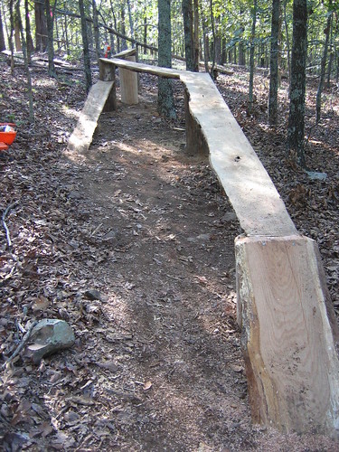
Jet Lowe continues to work with Bill Haire and others to build cool new trails at Loma Rica Ranch. The group could use your help. From Jet:

"Please join us for a couple hours of evening trail work. We have bug spray, technu, drinks, and homemade blackberry cobbler. Enjoy the rest of the evening under the gazebo. Please dress appropriately with long pants, long sleeve shirt, hat, etc. Status: Finished 3 of 5 single tracks

Dates: July 27-28
Time: 6pm
Location: Loma Rica Ranch, meet at Farm Stand
10980 Brunswick Rd.Grass Valley, CA"

Tuesday, July 21, 2009

Loney Meadows Trailwork

From the Gold Country Trails Council:

LONEY MEADOW RIDE/CAMP/TRAIL WORK - July 24-26, 2009

This is close to home and a beautiful area to ride. Camping is in an unimproved area, but does have a creek near by for stock water. You will need to high line your horse, tie to the trailer or bring your own portable corral. Start the weekend on Friday or come early Saturday for the 9:00 AM departure of the work party.

The trail work will be construction of the trail that will connect Loney Meadow with the Bowman Lake/Mountain trail. A section of that trail was obliterated by past logging in the area. In the event that the Forest Service (Joe Chavez) does not approve of the proposed route (inspection will take place July 23) the alternate work will be trail clearing. A section of the trail from the meadow to Rock Lake is quite overgrown. Please come prepared with loppers, hand saws, shovels, rakes, etc. Wear appropriate clothing...long sleeves, sturdy shoes, hat..bring water, sun screen, and your enthusiasm!

If you have not been to this area before, this is a great opportunity for introduction. If you not a camper, come for the day, as the distance is not too great. Travel time is about 1 & 1/2 hours from Grass Valley and it is a scenic drive. Take Hwy 20 east. (that is towards Reno) Left on Bowman Road. Travel about 10 miles on paved road. Just after the pavement turns to gravel look for a battered brown forest sign on the right for Loney Meadow. As you drive up that road, stay to the left at the fork. The short climb brings you out into a graveled area. Proceed to the right and across and then left on the continuation of the road to Loney Meadow. As you enter back into the more treed area, camping is on both sides of the road.

Please RSVP to Teri Personeni 273-9144. If you are camping please plan a pot luck dish for Saturday night dinner.

Monday, July 20, 2009

Pioneer Trail Ride - August 1st

Please join us on the monthly BONC ride on Saturday, August 1st @ *9AM* (note the start time). We'll ride trails in the Highway 20 corridor, including some lesser known fun sections. Meet near the Harmony Ridge Market on the north side of the highway.

We'll offer various ride options from *advanced to beginner*. The beginner group will be a No-Rider-Left-Behind ride. When we finish, we'll gather to enjoy some complimentary food prepared by BONC. Please bring a bike, helmet, water and mid-ride snacks. If you want to join BONC, we'll have memberships available.

As usual, we could use volunteers for this ride, including ride leaders, food bakers and someone to hang out at our booth during the ride. Let me know if you can help out, thanks.

Thursday, July 09, 2009

BONC Comments on Osborne Hill Development Plan

The Osborne Hill area adjacent to Empire Mine State Historic Park contains a valuable network of trails. For years, BONC has worked hard to advocate for the preservation of this trail system. Below is the letter BONC submitted to the Nevada County planning department in response to plans to develop the area. A big thank you to Nick George who spearheaded our most recent efforts.

BONC constantly works to improve and preserve local riding opportunities such as Osborne Hill. Please support our efforts by joining or renewing your membership today. As a 501c3, we also accept tax-deductible donations.

+++++++++++++++++++++++++++++++++++++++++++++++

Bicyclists of Nevada County (BONC)
P.O. Box 1311
Nevada City CA 95959
Nicholas George - Secretary
John J. Gardiner - Chairman
bonc.org

July 9, 2009

Mr. Tod Herman
Senior Planner
County of Nevada
950 Maidu Ave
Nevada City, CA 95959

SUBJECT: comments on Draft EIR for Osborne Hill, SCH No. 2006122098

Dear Mr. Herman:

Thank you for the opportunity to comment on the May 2009 Draft EIR for the proposed development of Osborne Hill, SCH No. 2006122098

With many in our community, the Board of Directors of Bicyclists of Nevada County (BONC) have serious concerns with the development's impact on existing trails frequented by non-motorized users. The proposed development covers an area containing a trail network, long valued and utilized by area residents. Our mapping confirms more than seven miles of existing trails. (This total under-represents trail lengths, given the labyrinth of such trails on Osborne Hill).

BONC is pleased to note that consideration of trails have been given substantial attention in the DEIR, with some 257 occurrences of the word "trail" within 16 documents (not including Appendix 15.11). This qualitative treatment notwithstanding, the plan is short on several key specific mitigation measures. After the development is completed, users want to be left with trails of similar length, character, and connectivity. The objective of all new trails should be to maintain connectivity to trails outside the development that is lost by the construction of homesites, roads, sewage treatment facilities, utilities, etc. Without maintaining connectivity, the loss of the trails becomes significant for trail users because they can no longer get from "here to there". Trails that merely circulate within the development are inadequate mitigation.

As shown in Table 3-8 of the DEIR, the only proposed trail with wildland characteristics (orange line "Proposed new multi-use trail"), at roughly one mile in length, is far too short to be considered adequate mitigation for the loss of more than seven miles of existing non-motorized trails. BONC concludes that the single orange line "Proposed new multi-use trail" is inconsistent with the claim on Page 3-22 that the developer's proposal is a "replacement" for the loss of more than seven miles of trails.

As a single trail connecting Osborne Hill Road (on the West) with the PG&E transmission line maintenance road (on the East), the Table 3-8 orange line "Proposed new multi-use trail", is vulnerable to user type restrictions, as provided for in Section 5.4-32. For these reasons, BONC insists that at least three "Proposed new multi-use trails" be required of the developer, so that should a trails management plan recommend the segregation of user groups on different trails (equestrians separate from pedestrians, separate from bicyclists), connectivity will not be lost for any user group. Ref: Section 5.4 "Bicycle and Pedestrian System". Ref: Appendix 15.11 Open Space and Habitat Management Plan.

The edge-of-road and edge-of-homesite trail (Table 3-8 blue line "Proposed new roadside trail') is significantly different in character from the orange line, in that it does not provide a wildland user experience; therefore it is not appropriate mitigation for loss of wildland trails. BONC notes that edge-of-homesite trails are often encroached upon by homeowner activity. The ridgetop section of blue line trails in Table 3-8 (and Appendix 15.11, Table 4) does not appear to meet the intent of the requirement in for 50 foot vegetative privacy buffer between trail and development, as Elder Drive and Lots 7, 8, 9, and 10 are all part of the "development". Ref: Appendix 15.11 Open Space and Habitat Management Plan, Page 29.

Leaving trails management to a Homeowner's Association doesn't work, because there is an inherent conflict of interest between trails easement enforcement, and residents who may not yet be enlightened enough to value trails adjoining their property boundaries, especially if such trails are used by "outsiders". Ref: Section 8-21, MM 5.7-8i. Homeowner's Associations have little motivation to spend time and money for trails used by non-residents, or not used by residents.

Trails management should be performed by a separate entity, such as a Nevada County Parks and Recreation District, a land trust (perhaps the Nevada County Land Trust), or a non-profit, such as BONC. Funding for trails management needs to come from an assured source (such as taxes or an endowment), not merely a variable assessment to development's residents, that is vulnerable to reduction by votes of a Homeowner's Association. Until such time as management is transferred to one of these entities, specific audits for compliance to the CC&Rs need to be conducted, as recommended in Appendix 15.11 Open Space and Habitat Management Plan, Part 1, Page 9.

The recommendations for Trails Management contained in Appendix 15.11 Part III, Pages 21-26, while laudable, are only recommendations. What actually happens (or does not happen) on the ground can be very different, without enforcement and auditing by an outside entity.

We ask that the County of Nevada insist that the developer resubmit a new plan that more adequately addresses these issues.

Thank you for your consideration.

Sincerely,

Nicholas George
Secretary, Bicyclists of Nevada County
(a 501c3 corporation)

Monday, July 06, 2009

July BONC Gala Ride Recap

As expected, we had a modest turnout for the July 4th BONC monthly gala ride, but what we lacked in numbers, we made up in sheer fun.

Starting from the USFS ranger station, we played around on some very cool features at Noab for a while. I've ridden more skinnies this weekend than during the previous 12 months. We left before anyone got hurt and then headed up Snow Mountain Ditch > Taxi Cab. TC sees much less traffic now that Miner's is mostly singletrack, but it is still a cool trail that provides a nice alternative. We rode Pioneer, looped around the Rock Creek Nature area and headed back down the hill.

Do you have a ride venue in mind for a future gala ride? Let us know and maybe we can make it happen.