Friday, February 08, 2008

Coming Soon: 14 Miles of New Singletrack

This week, the Auburn Journal reported that dirt will soon be turned for the creation of the North Fork Trail in Auburn. This was confirmed to me by a source close to State Parks.

The article does not mention, however, threatened legal action by those opposed to the trail. A few malcontents have made noise that this non-motorized trail might spoil the splendor of the area. I wonder how these people know that this area is so splendid. Perhaps by hiking off trail illegally and trampling the unspoiled area?

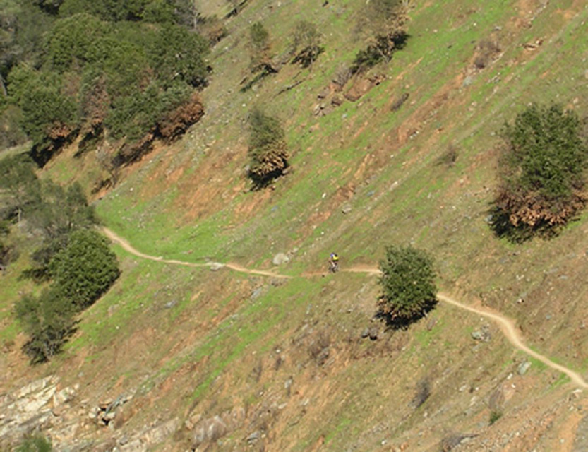
In any case, the trail will be fantastic. It will provide a whole new riding option from the Confluence area. You can ride up Clementine until you reach the split off for this new trail, where you can ride out 14 miles to Ponderosa Bridge and back. I know there is one trail/fireroad that climbs up from the new trail that will get you near Fuel Break, but I cannot recall its name. Perhaps it is the Lake Clementine Access Trail (PDF)?

Saturday, February 02, 2008

BONC Potluck Postponed

Because of this unusual weather, tonight's BONC meeting is postponed. We'll have a new date for this event ASAP.

Go drink some hot chocolate.

Friday, February 01, 2008

Osborne Hill - Some Progress

The CDF has responded with to the Timber Harvest Plan (THP) submitted for Osborne Hill and their comments are very favorable for the cause of trail users. Essentially, the CDF found that the plan was riddled with inaccuracies and misinformation regarding everything from toxic substances to logging techniques. Most importantly for us, the CDF specifically called out the importance of trails on the property and how the THP does not address how trail usage would be affected by the logging.

The CDF suggested that the logging proponent withdraw the plan. While this sounds like a victory, who knows if the logging proponents will abide by these suggestions and withdraw the THP or just submit another half-baked proposal in the future. They seem just about as hard headed and clueless as they have all along.

Thursday, January 31, 2008

Superbowl Ride

From BONC VP Hyland Fisher:

"Join us for the semi-annual Superbowl ride on Sunday, February 3rd, 2008. Meet at 10:00 am at the Flour Garden in downtown Grass Valley, CA (or the Flour Garden in Auburn, CA at 11:00 am).

Since there is so much snow up here in Nevada City / Grass Valley, we are taking the ride to Auburn or Cool. Please RSVP so we know who and how many to expect. Call me if you are unsure if the ride is going to happen because of the weather. My phone number is below.

This ride is open to all skill and fitness levels, consider it a "family friendly" event.

Be sure to dress appropriately, wear an approved helmet, bring food and water and make sure your bike is in safe working order.

We will decide (based on who shows up and the weather) which trails to ride and for how long.

If anyone wants to volunteer their home for a post ride potluck and Superbowl viewing party then please let me know."

Wednesday, January 30, 2008

BONC Looking for Input

At the BONC meeting this weekend (see cyclists calendar), the club will create a steering committee that will lead the club.

Interested in serving? It is not a big commitment, but it is an important one. You will help lead us make trail-related decisions.

If you are interested, let me know.

Saturday, January 26, 2008

Union Editorial

Today, the Union ran my Other Voices editorial piece about expanding Empire Mine and the trails on Osborn Hill. Be sure to check it out.

And of course, please consider submitting a letter to State Parks and CDF. The sooner the better, as CDF is reviewing the logging plan now.

Thursday, January 24, 2008

Round Mountain Trail Work Rescheduled

Because of Nevada County weather similar to that of my native New England, BONC needs to reschedule this weekend's trailwork on Round Mountain. Instead, you should go out and snowshoe or ski.

Wednesday, January 16, 2008

Residents and Trail Users Fight Logging Plan

Today the Union ran a front page feature story about the planned massive logging operation on Osborne Hill and how many of us are standing up to fight it. Be sure to check it out.

Contrary to what many might think with the current state budget crisis, there is plenty of voter-approved proposition money to pay for State Parks acquisition of Osborne Hill. This is why we need you to write State Parks to bug them about acquiring this parcel.

Monday, January 07, 2008

Updated Map

I've updated the Osborne Hill map with a bunch of details: photos, logging plan boundaries and the new road construction should the insane timber harvest go though. Check it out. You can embed this map in your own web page if you want - learn how.

Please consider writing State Parks and the CDF to help stop this absurd logging plan.

Added to the Empire Mine State Historic Park, this parcel would increase the size of the park by ~30%!

Wednesday, December 26, 2007

Maps of Osborne Hill

I've posted two maps related to saving trails at Osborne Hill. This map shows the approximate parcel boundaries of the property. I plan to update this soon with clickable images.

The second map (1.8MB PDF) shows the timber harvest plan. If you want to stop the obliteration of these trails, learn how. Thing is, we all need to act ASAP, as the CDF is considering the timber harvest plan now!

Tuesday, December 18, 2007

Save Riding Near Empire Mine

I've created a new web page dedicated to saving the trails and open space on Osborne Hill near Empire Mine. The would-be developer of this parcel plans a huge logging operation (THP 2-07-124-NEV(3) in a plan that does not accommodate or even acknowledge the existence of important trails in the area. After this, he plans to erect a bunch of McMansions that will lie right on top of trails we've used for years.

What is the alternative? People like you help the effort to annex the property to Empire Mine State Park. Read all about it.

Monday, December 17, 2007

Round Mountain Trailwork - Saturday, January 26

From Hyland Fisher, VP of BONC: "Join us for our 2nd ever trail work on Round Mountain! We will be conquering two projects.

1) We will be rerouting the trail that goes down to Coyote Overlook. This will become a destination, not a thru path. The new trail will be uphill from this location.

2) We will be installing culverts in two locations where a creek crosses the trail.

Meet at the Forest Service office at 631 Coyote Street, Nevada City, at 10:00 am on Saturday, January 26th, 2008.

We will have food, drinks, beer and maybe even some free schwag! Rain or bad weather cancels. Stay tuned to your email (the BONC email list) for further info."
Images of Round Mountain No-Moto Signs

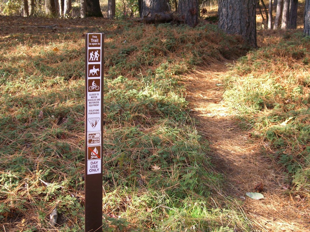
On our ride yesterday, I snapped a few pictures of the new no-moto signs on Round Mountain. They look great and are well placed at trailheads in the area.

For some reason, I find the creation and installation of these signs to be very gratifying. BONC is all about cooperation and promoting and saving trails. The sign project involved lots of cooperation with the Round Mountain community and the BLM to help stop trail damage from mindless motoheads.

Thursday, December 13, 2007

FDLT Trailwork

From FATRAC:

We have trailwork scheduled for December 16th on one of the area's favorite trails. Do you enjoy FDLT? Come out and make it better!

Sunday December 16th, 2007
Description: Come out and help us clean our trail. Contact the trailwork coordinator to confirm if chance of rain.

Meeting Location: Grizzly_Bear_House
Meeting Time: 9:00:00 AM
Leader: Ron Dickenson

Tuesday, December 11, 2007

Round Mountain No Moto Signs are Up

The BLM tells us that they have erected no-moto signs at all important trail heads on Round Mountain! Yewhooo! This came about because of a BONC request about a year ago. Hopefully, this will deter at least some moto riders from poaching this area.

This project also has the nice side effect of engendering good will between BONC and the Round Mountain community.

Monday, November 26, 2007

More Fun on the Sandusky Trail

Alison sends us some details on the upcoming Sandusky trail building extravaganza:

"Dates: Friday, November 30th - Tuesday, December 4th, Weather permitting.

Scope: Work is proposed to commence Friday morning from three points on the remainder of the unfinished section of the Sandusky Trail. Access to these starting locations will be from the Ridge Road Trail Head. This is approx. 3 miles past the Forest City "mountain house road" turnoff on Ridge Road. Trail head will be flagged with vehicles parked along road."

No idea when the trailwork begins though. Alison? Zachi?

Tuesday, November 13, 2007

Trail Building at the Old Airport

Word is that about ten people helped out to build and improve trails at the old Nevada City airport last week. The effort was head up by Debra Little and featured the talents of the Miners high school team. I have not made it up to the airport to check out the work, but Debra tells me that they finished everything they intended to get done.

Trails so close to town are super important. They represent recreational opportunities for everyone without requiring a long car trip to access them.

Wednesday, October 31, 2007

Narrow Gauge/Tressel Trail Work Day - Sunday, 11/4

From the GCTC: Due to forecasted inclement weather, this work day has been rescheduled to Sunday, November 4. Questions? Please contact Melissa at 530.268.1378

Volunteers needed to complete this important project! This is the last workday of the year and your last chance to come out and make a difference on our trails.

When? Sunday, Saturday, October 20, 2007
Time? Meet at Skillman Campground (13 miles east of Nevada City off Highway 20) at 9 a.m. We will carpool from Skillman to the work site and be finished by 1 p.m.

Why? We will be completing the re-route of the Narrow Gauge/Tressel Trail. Please bring loppers, rakes and shovels. Bring drinking water and a lunch.

Per Forest Service requirements, long sleeve shirts and pants and close-toed shoes are required; please wear gloves. Hope to see you there!
Recap: Empire Mine Workshop

Saturday's Empire Mine trail workshop was very positive and super exciting; generally speaking, State Parks has some great plans for new trail and restored trails in the Osborne Hill area of the park.

Starting as early as March, State Parks will begin construction on new sections of trails. Pending input from the community, they will generally use the same names, but the trails in this area will be very different. The net mileage of trails here will increase a bit, but most exciting is that much of the new trails will be comprised of singletrack.

State Parks plans to re-work the super fun user-built trail that follows the fence line along Osborne Hill Road to be mountain bike-specific. This means it will be optimized for mountain bikers, with rock armoring and fun up-and-down sections.

The existing Powerline, Osborn Hill and other trails will be complete removed and replaced with singletrack. There will be a net loss of fireroads in this whole area of the park, which will be replaced by singletrack on a 48" bench cut, which of course will narrow to an ideal width within a few years

The two parts of the proposal that I am not happy with are the sections of hiker-only trails and the proposal to remove some user built trails. The hiker only built trails idea was widely denounced by attendees (equestrians, cyclists and even some hikers) and I believe that State Parks got the message that this is lousy idea that would deprive many of us of trail access. As for the user built trails, I believe that some of these are sustainable trails that should be adopted in the system as-is or with some modifications.

These plans are in draft form and State Parks want your input ASAP. Note that this project is fully funded. This means that whatever final plans are agreed upon will move forward very soon. This is why it is important to comment on this projects within the week.

Tuesday, October 16, 2007

Nevada City Trailwork, 11/3

Please join the Miners high school mountain bike team as we revive the trails around the old airport in Nevada City. This is your chance to add to local riding so close to town.

Meet at 9AM at the old airport parking lot. To get there, head up Airport Road (see map link below). If bad weather occurs, please call 530-274-DIRT after 7:00AM on 11/3 to determine if the event will be rescheduled. Map.
Forest City Trailwork

Sunday's planned trailwork at Bullard's was moved over to Forest City upon the suggestion of Joe Chavez of the USFS. There we worked on an entirely new section of the Sandusky Trail that has been punched in by Zachi Anderson. This new section is *great* and represents of lot of talented work by Zachi. The new section of Sandusky will be sweet to ride once winter works its magic on it. There are also some freeridish features on it that I look forward to hitting.

Today's effort involved finishing work on the trail bed by BONC volunteers, as Zachi worked the excavator. I believe Bob, Jimmy and Christine joined Joe Chavez on some brushing work as well. Thanks to everyone who helped out.

Pictures:
http://picasaweb.google.com/velojohng/SanduskyTrailwork

Thursday, October 11, 2007

Bullard's Bar Trail Day

Please join BONC as we help improve this exceptional trail system with the Forest Service. We'll have some swag for participants, food, drink and quality beer. I am sure some of us will ride afterwards.

Meet @ 9AM (note the time) on Sunday, 10/14 at the Dark Day boat launch (map). If bad weather occurs, please call 530-274-DIRT after 7:00AM on 10/14 to determine if the event will be rescheduled.

Thursday, October 04, 2007

Empire Mine Workshop - Saturday, 10/27

Did you know that State Parks is considering re-routing and closing some existing trails in Empire Mine and building brand new ones? The park wants to hear from you about all this. Please plan on attending this super important workshop (see below). You'll be able to speak firsthand with the folks who will create new trails at the Mine:

++++++++++++++++++++++++++++++

FOR IMMEDIATE RELEASE:
Contact: Sheryl Watson, Information Officer
(916) 654-7538
October 4, 2007

Ron Munson, Sector Superintendent
(530) 273-3884

Empire Mine State Historic Park Works to Improve and Reopen Trails
Public Invited to Workshop and Hike Through Osborn Hill

WHO: California State Parks' Superintendent Ron Munson and Trails Manager Karl Knapp.

WHAT: California State Parks invites trail users to review and discuss proposed realignments and improvements to trails in the Osborn Hill area of Empire Mine State Historic Park.

WHEN: Saturday, October 27 in the Docent Building. Come to the main visitor parking lot and into the mine yard. The Docent Building backs up to the parking lot. Open House: 9 a.m. - 10 a.m. Maps and information will be available for viewing. Workshop: 10 a.m. - 12 p.m. Presentation and Q & A.
Hike: 2 p.m. - 5 p.m. Hike participants meet at the Penn Gate parking lot at 2 p.m. Participants
must arrive with good walking or hiking shoes, a water bottle and appropriate protection from the weather. Rain will cancel the hike.

WHY: Portions of the Osborn Hill trail network were closed in January based on environmental
sampling data showing elevated levels of arsenic and lead. These metals are naturally
occurring, often in areas where gold is found, and may have been brought to the surface
during historic gold mining.

California State Parks and Newmont USA Ltd. are working to address the environmental
issues. California State Park is examining a plan to re-open closed areas to the public while
remaining protective of public health. Proposed new trail routes are being tested for metal
concentrations. Unlike most existing trails in the park that are former mining roads, the new
trails will be carefully designed and graded so as to resist erosion, allow better water
drainage and withstand heavier recreational use.

Trail users are encouraged to provide their input on trail improvements in the Osborn Hill area
during this planning stage. For more information, please contact the Visitor Center at (530) 273-8522.

Thursday, September 27, 2007

Narrow Gauge/Tressel Trail Work Day

From the Gold Country Trails Council: Volunteers needed to complete this important project!

Gold Country Trails Council - Saturday, October 20, 2007 Meet at Skillman Campground (13 miles east of Nevada City off Highway 20) at 9 a.m. We will carpool from Skillman to the work site and be finished by 1 p.m.

We will be completing the re-route of the Narrow Gauge/Tressel Trail. Please bring loppers, rakes and shovels. Bring drinking water and a lunch.

Per Forest Service requirements, long sleeve shirts and pant and close-toed shoes are required; please wear gloves. Hope to see you there!
BONC Website Wins Award

The BONC website won an award from American Trails for its Trail Guide page. The award was in the category of "TRAIL TOUR or virtual visit". Learn more.

According to American Trails: "We looked for sites that really make trails come alive, and provide effective information delivery, support volunteers, and engage the public. In short, we want to showcase ways that advocates and agencies are making a difference for trails."

The BONC Trail Guide page "uses Google Maps and Earth to depict trails in the foothills of the Sierra Nevada Mountains".

Monday, September 24, 2007

Lots of Trail Days Coming Up

Want to help make local trails second-to-none? Consider participating in these events:

Bullard's Bar, 10/14 - Please join us as we help improve this exceptional trail system with the Forest Service. We'll have some swag for participants, food, drink and quality beer. I am sure some of us will ride afterwards. Meet @ 9AM (note the time) on Sunday, 10/14 at the Dark Day boat launch. If bad weather occurs, please call 530-274-DIRT after 7:00AM on 10/14 to determine if the event will be rescheduled. Map of the Dark Day boat launch.

Old Airport, 11/3 - Please join the Miners high school mountain bike team as we revive the trails around the old airport in Nevada City. This is your chance to add to local riding so close to town. Meet at 9AM at the old airport parking lot. To get there, head up Airport Road (see map link below). If bad weather occurs, please call 530-274-DIRT after 7:00AM on 11/3 to determine if the event will be rescheduled. Map.

Round Mountain - The BLM has asked for approximately three volunteers to help install no-moto signs on trailheads at Round Mountain in October. This should be a short time commitment. Please respond to me if you are interested.

Monday, August 13, 2007

New 14 Mile Trail in Auburn?

Here is how you can make it happen:

Please take a minute to review the following information from Placer County Parks Department! It's about plans for a new trail from the Confluence. Here is how you can help:

Writing a quick letter to Mr. Andy Fisher at the address below to express support for the trail; and/or

Attending the public meeting in Auburn. Say you hope the trail will be a width much like the Connector, which was built with a SWECO and has developed a nice, narrow line. Mention that a new trail will disperse the heavy use on existing trails to improve the trail experience of everyone. Say you ride FDLT and other Confluence area trails, and have done volunteer trailwork with FATRAC, and would appreciate riding and volunteering on a new trail.

Thanks for showing your support for a new trail. If you have any questions, let me know.

Cathy Haagen-Smit
FATRAC Secretary

********************

North Fork American River Trail Project DEIR

A Draft Environmental Impact Report (DEIR) for the North Fork American River Trail project has been completed and is available for review and public comment.

The proposed natural surface trail would begin at the confluence of the North and Middle Forks of the American River and end at the Ponderosa Bridge, approximately 14.2 miles upstream. It could be used by hikers, equestrians and mountain bikers. Bridges and stream fords, staging areas, a restroom facility, signage and informational kiosks are also part of the proposed project.

The Placer County Facility Services Department is soliciting the views of interested persons, agencies and organizations regarding the project. Copies of the DEIR are available for review at the Auburn Library, 350 Nevada Street, or at the Placer County Facility Services office at 2855
2nd Street in the County Government Center, also in Auburn. It may also be viewed online or downloaded at www.placer.ca.gov .

A public meeting is planned for Thursday, August 23, at 6:30 p.m. to share information and receive comments. The meeting will be held in the Planning Commission Hearing Room in the Community Development Resource Center, located at 3091 County Center Drive in Auburn.

Written comments will also be accepted through 5 p.m. on Monday, September 24, 2007. They may be submitted to the Facility Services Department, c/o Andy Fisher, 11476 C Avenue, Auburn, CA 95603.

Thursday, July 26, 2007

Pioneer Trailwork @ Langs Crossing

BONCers have kindly offered to trim back the badly overgrown section of Pioneer Trail at Lang's Crossing. We could use a few more volunteers to make quick work of this section. My guess is that this is a bite sized project that can be done by noon. Than you can swim, bike or whatever near Grouse Ridge :-)

Sunday, August 5th
Meet at Flour Garden @ 8AM to carpool or meet at Lang's Xing @ 9AM (see below)
Bring gloves, long pants, long sleeved shirt and perhaps some insect repellent
If you have loppers or clippers, please bring them

Map of Lang's Xing:
http://tinyurl.com/2o3b5d

Thursday, July 12, 2007

Help Create a Bike Park in Grass Valley!

As you may know, I have been advocating on behalf of a bike skills park in Grass Valley for several years now. This facility could include dirt jumps, teeter totters, a pump track and more. The Grass Valley Parks and Recreation Commission has generally been supportive, but they need to hear from you. We need to convey that there is significant community interest in this project. If enough of us speak up, I have no doubt that this facility will become a reality.

HOW YOU CAN HELP:

Please submitting a letter the Parks and Recreation Commission using the following sample letter as a template (see below). Also consider forwarding this email:

+++++++++++++++++++

Parks and Recreation Commission
City of Grass Valley
123 East Main St.
Grass Valley, CA 95945

Dear Commissioners:

This letter is intended to express my support for a bicycle skills facility in Grass Valley, preferably in Condon Park.

Such a facility would terrific recreational asset for the City.
A bicycle skills park serves similar functions to a skatepark, as it enables both young and old riders the chance to use and improve their skills. Kids love to expand their abilities on dirt jumps and obstacles at these parks. Such a facility provides a vital opportunity for children to get away from the TV and go get some fresh air and exercise.

Such facilities have been successfully implemented elsewhere in Northern California on municipal land, including Pleasanton, San Jose and Folsom. With proper construction, appropriate layout and compliance with environmental standards , these examples have proven that liability and risk can be reasonably managed. It is possible to use supplemental volunteer labor to construct such a park for a very reasonable cost as compared to other public recreational assets.

Thank you for your consideration.

+++++++++++++++++++

Wednesday, July 11, 2007

Bicycle Master Plan Meeting Recap

Last night's public county Bike Master Plan meeting was cordial and in fact very productive. The plan is laudable (yes, I did just call it laudable) in many of its suggested improvements to PAVED cycling in Nevada County. Given that Caltans has allocated significant money for PAVED cycling and impressive local efforts to target this funding, riding bicycles on PAVED surfaces in Nevada County will hopefully see some dramatically improved conditions in future years.

I and many others at the meeting still fault the plan and county for not considering trails as part of this plan. Or perhaps we would feel better about this omission if Nevada County government had a better (any?) record of planning for and accommodating trails across the county. In any case, there is a glaring hole in planning for cycling in our rural area when bicycling on trails is not acknowledged in any formal plan.

But herein lies the silver lining: Mike Woodman of Nevada County Transportation Commission (NCTC) told me that the County has allocated some $85,000 in this years fiscal budget for creation of the Non-Motorized Transportation Plan. And here, BONCers, is our opportunity to improve trail riding and target funding for new and better trails. BONC needs to be on top of this process beginning *now*. We need to contact NCTC, supervisors, whomever to let them know that we expect follow through on a plan that adequately depicts trails in this county.

Thus is see the need for to action items from last night:
  • A letter from BONC that endorses the bicycle plan with some changes, specifically that it be renamed something/anything other than "Bicycle Master Plan" and that it should formally recognize the importance of trails to Nevada County's cyclists.
  • BONC heavily involves itself in planning for the Non-Motorized Transportation Plan. Let me know if you want to help.

Thursday, June 28, 2007

Diamond Arrow Trail Flagged

In case you missed it, we have flagged a preliminary route of the Diamond Arrow Trail. From the BONC list:

"An update to the Diamond Arrow Trail project: yesterday, Bill Haire, John Rapphahn of the BLM and myself finished flagging a preliminary route for the entire trail. This was the result of five scouting expeditions by Bill, others and myself over the past few years as we sought out an optimal route for this new trail. I think the preliminary route is very good and will provide an excellent multi-use trail experience for everyone, including the kids at the Diamond Arrow camp.

Next, the BLM will file environmental docs and have a biologist/archeologist/experts survey the route and sign off. We also will work with the Diamond Arrows Conference Center to secure an easement across their property; they have already indicated their willingness to do this. It is my hope that we can begin turning dirt on this trail this winter!

You can see the preliminary route here:

Google Earth:
http://www.bonc.org/KML/diamond-arrow-trail.kmz

Same data in Google Maps:
http://tinyurl.com/2hntw3"

Wednesday, June 13, 2007

Help Improve Auburn Trails!

As we know, Auburn State Recreation Area offers superb trails. NorCal IMBA rep Jim Haagen-Smit asks that you help make them even better:

"Do you appreciate the trails you ride in the Auburn State Recreation Area? Participate in a planning process now underway!

The Auburn State Recreation Area Management Plan is being updated by State Parks. Thanks to those of you who've attended stakeholders' meetings and the May 30 public workshop. State Parks is gathering comments until June 30, but the sooner the better. For background you may visit the webbsite: http://www.parks.ca.gov/?page_id=24325

Email comments to: jmiche@parks.ca.gov

Or mail:

Jim Micheaels
California State Parks
Gold Fields District
7806 Auburn-Folsom Road
Folsom, CA 95630

Please make personal comments and thank State Parks for volunteer opportunities, access, race venue at Olmstead, support of Endurance Capitol theme, and bike businesses, etc. Possible asks:

The plan should include equal miles of trails between the user groups (currently mtbs are allowed on 60 of the 115 miles - 12 of those at Mammoth Bar. Equestrians get 90 miles).

Add a multiple use loop in the upper middle fork zone - none currently exist now.

Support the North Fork Trail plan by the County. (need another trail to disperse users from popular Clementine/Connector Trails.)

Request safe access to river at Oregon Bar (State Parks have mtbs on the road with cars, instead of the near-by trail.)

Request safe and more enjoyable Auburn to Cool trail.

Support multiple use trails (single use trails are difficult to enforce, promote polarity, have high impacts on limited natural resources.)"

Thursday, June 07, 2007

Beginning Intermediate Mountain Bike Ride

Darwin invites you to the following"

"Beginner / intermediate mountain bike ride. Most Saturdays, Empire Mine State Park. Meet at Chiropractic + 605 South Auburn Street, Ste: D Corner of Empire & South Auburn Streets /Front parking lot Empire Professional Building. Rain Cancells. Call 530-273-8082 (press 6 to leave message) day prior, or early morning of to see if ride is on for that day. Need H20, proper clothing for temps, bike, replacement tube, helmet, good attitude. ( : Hope to see you there... Darwin S. Leek, D.C."

Thursday, May 31, 2007

Trimming Back the Nasty Stuff

This goes out a bit late, but kudos to the fine volunteers who have trimmed back poison oak on the South Yuba trail in the past month. These people include Mike Haire, Dave Lawell, George Maier and others. This time last year, the trail was badly overgrown with the nasty stuff, enough so to make it unusable to many of us. But now it is in great shape. Thanks guys!

I've been encouraging other trail users to bring clippers and folding saws with them on their hikes and rides. Local offices of federal land management agencies have seen budgets for trail maintenance staff slashed this year. Thus it is up to us to make up the difference.

On my rides, I carry a pair of cheapo hand clippers and this Felco folding saw. This saw is amazingly effective at trimming anything up to 5-6" thick. I've pruned back a lot of manzanita on trails near Osborne Hill in the past few months.

Wednesday, May 23, 2007

When Horses Attack!

(Just kidding with title of this posting :-)

From Joe Chavez of the Tahoe National Forest:

"FYI - The annual horse endurance event will be happing this weekend. They will be using some of the trails in the Burlington area and Pioneer Trail. They posted a sign at Chalk Bluff Staging area last weekend. Please let your club members know this will be going on. Thanks, Joe"

Please note that there is yet another equestrian event the following weekend too. So unless you enjoy hiking or riding a mountain bike through dust and horse turds, find another place to ride. Where? The South Yuba is in great shape, as local mountain bikers have spend many hours trimming back poison oak in the past few weeks.

And lest my equestrian friends think I am picking on them, let me acknowledge that the Gold Country Trails Council just put in a ton of trailwork on the Halllujah Trail extension and Rock Creek Trail. Rock on, Wilbur!

Tuesday, May 22, 2007

Improvements to the Excelsior Trail

Several volunteers with the Nevada County Woods Riders dedicated some quality volunteer time to improving switchbacks on the Excelsior Trail near Burlington Ridge. According to Joe Chavez of the Tahoe National Forest:

"I had two NCWR volunteers help me reroute the 2nd climbing turn on Excelsior Trail (bottom of 19 turns) on Sunday (5/20/07). They each contributed 3 hours (including driving time). The old one was too steep coming out of it and was rutting pretty heavily already."

More work needs to be done on this trail, but I am glad to see the original route improved.

Monday, May 21, 2007

Help Shape the Future of Riding in Auburn

Jim Haagen-Smit reminds us:

"Please plan on attending a workshop on May 30, 6:30 pm in Auburn - Canyon View Community Center, 471 Maidu Drive, Auburn.

The Management Plan for the Auburn State Recreation is being updated. This includes our favorite trails from Auburn-to-Cool, to the Foresthill Divide Loop."

I agree; this is a very important process and we need to work with State Parks to improve and optimize mountain biking opportunities at ASRA. These management plans are where important issues are decided, such as implementing or improving new trails, resolving user conflicts and establishing cooperation between user groups and State Parks.

Learn more.

Wednesday, May 16, 2007

High Elevation Trails Melting Out

On Sunday, a bunch of us rode Blue Lake Trail > Grouse Ridge Trail > Spaulding Lake Trail. For those of you who don't know this route, it sits near the junction of Highway 20 and 80 in the Tahoe National Forest and tops out at about 6100'. We encountered very little snow and enjoyed a gorgeous ride on some wickedly technical terrain. The Grouse Ridge Trail descent is as crazy as ever; "rock garden" does not even begin to describe it.

I managed to shear off my derailleur hanger early in the ride, but was able to make a completely functioning conversion to a single speed, with SS-like gearing (~32x18). So I got to experience the rockiest terrain around here on a hardtail singlespeed. Funny enough, I really enjoyed this setup and was able to ride all but a few sections.

Much beer and chips were had at Fuller Lake at the end of the ride.

Tuesday, May 08, 2007

It is Official: Bill Haire Rocks!

On Friday at the California Trails and Greenway Conference, Bill Haire will receive a Lifetime Achievement award for his ceaseless work on trails over the course of his career. Whether as a USFS staff member, Nevada County Land Trust Trails Coordinator or plain old volunteer, every single mountain biker on this list has benefited from his efforts on local trails. There are outstanding trails near Downieville, Bullards Bar, Burlington Ridge, Grass Valley/Nevada City, Grouse Ridge and elsewhere that would never have come to pass without Bill's quiet but relentless efforts. And sometimes, it seems that he is just getting started (or at least he likes to think so).

The next time you see Bill, be sure to thank and congratulate him. Chances are, he'll have a volunteer trail project that needs you some time in the next few weeks :-)

Tuesday, April 17, 2007

Pushing for Grass Valley Jumps

This afternoon, I made a very brief presentation to the Grass Valley Parks and Recreation Commission about implementing a bike skills facility on city property. This facility would be comprised of dirt jumps, a pump track, obstacles and more. Again, the commissioners were receptive and one mentioned her intention to check out the new bike skill facility in Folsom at Cummings Park. They asked a few questions about maintenance and security of such an area, but said nothing indicated that they are opposed to the project.

As is often the case with new trails, this will be a classic case of slow progress toward a fantastic final goal. I plan to remain persistent and continue to get our ducks in a row until opportunity presents itself. I am convinced that ultimately, Grass Valley will have a sweet bike skills park.

Thursday, April 12, 2007

Osborne Hill Trails Threatened - Help Save Local Trail Access!

Developers have planned to implement a high density, out-of-town, expensive home development atop Osborne Hill near Empire Mine. As many of you know, this area is packed with outstanding singletrack that has been used for decades by cyclists, equestrians and hikers alike. Current plans for this development would obliterate much of this trail network with disregard for existing usage.

State Parks has expressed interest in acquiring the property and annexing it to Empire Mine Historic State Park. There are pending grant applications supported by the Nevada County BOS and the Grass Valley City Council that would make this annexation a reality. Trail users and the community would be best served by this approach, instead of another high end development far from town that shows no regard for existing trails.

WHAT YOU CAN DO:

Nevada County is accepting public comment on this proposed development. Please comment by APRIL 23 using a version of the sample letter below or your own tailored message:

++++++++++++++++++++++++++++

Tod Herman
Nevada County Planning Department
950 Maidu Avenue
Nevada City, CA 95959

Dear Mr. Herman:

This letter is in regards to the proposed Osborne Hill Project. As an area resident and trail user, I am very concerned about this proposal for the following reasons:

- The proposal does not accommodate or preserve existing trails or trail access. This area includes an extensive network of publicly used trails used by the community for many years.

- The proposal involves extensive grading and vegetation removal, all of which will negatively impact these trails. The plans do not address how existing trails will avoid damage from this disruptive activity.

- The proposal involves extensive construction of roads and buildings including an extensive sewage treatment field. Again, such construction will either negatively impact or completely destroy existing trails. Such impact is not addressed in the application.

- The proposal does not address if existing public trail access will be preserved in the development. Such trails should continue to be acknowledged and supported by any such proposal.

In conclusion, this application is incomplete until it fully addresses these issues. I urge the County not to accept the application until the project is sharply reduced or altered so as to accommodate public trail access.


Truly,
YOUR NAME HERE

Wednesday, April 04, 2007

Help Build the Rock Creek Trail

The Gold Country Trails Council will be hosting a Rock Creek Trail Work Day on Sunday, April 29, 9 a.m. - 1 p.m. From the GCTC:

Bring: Loppers, gloves, shovels, hand saws, drinking water and snacks. Plan on wearing the Forest Service required "uniform" (long pants, long sleeve shirt and closed toe shoes).

Why: To complete the construction of the Rock Creek Trail that was started last fall. And to have a fun time working outdoors in the beautiful forest with your fellow club members.

Directions to Rock Creek Nature Trail Head: Take Highway 20 east out of Nevada City towards Reno. Approximately 6-7 miles out of Nevada City, turn left on Forest Conservation Camp Rd. Go about 1 mile and look for a dirt/gravel road on the left leading towards the Nature Trail. Travel down this dirt road to the bottom where the Nature Trail Parking Lot is located."

Wednesday, March 28, 2007

Diamond Arrow Trail Progress

Earlier this week, Bill Haire of the Nevada County Land Trust, John Rapphahn of the BLM and I scouted a route for the upper (southern) section of the forthcoming Diamond Arrow Trail. You can view a track of the route we flagged:

View upper route in Google Maps
View upper route in Google Earth

One important thing I learned on this expedition is that it may be possible to keep the entire trail on BLM property, which would make planning and construction much simpler. Originally, I had thought that the trail would have to cross the Diamond Arrow property.

This project has long been dear to my heart, as I see this trail as a great addition to the South Yuba trail system. It seems that there is some momentum now to move this project along. The BLM may have some resources to conduct the necessary environmental assessment this year. Once that is in place, we can begin construction.

The terrain that this trail will traverse is similar to other areas near Round Mountain. Lots of nice views, poison oak, decomposed granite and steep canyon slopes.
Auburn Alert

IMBA State Rep Jim Haagen-Smit passes this along:

"ALERT: Auburn State Recreation Area Update

Mountain bikers should be aware of two issues concerning riding
opportunities in the Auburn State Recreation Area. First, State Parks is drafting a feasibility study regarding the Auburn to Cool Trail. Second, the management plan for the entire ASRA is being updated. It is important the mountain bike community be at the table. That's you!

Regarding the AtoC trail, it is general consensus that the current trail alignment is too steep and not all that fun. Additionally, the current river crossing has gone away now that the river is being restored into its channel, so agencies are reviewing crossing options. What would you like to see? A big expensive new bridge? A seasonal crossing? Use existing bridges, such as the Mountain Quarries Bridge (currently closed to bikes) or Highway 49, with new well-designed, sustainable trails between Auburn and Cool. Take a moment to send in a quick comment to:

Auburn to Cool Trail Crossing Study
Attn: Jennifer Rogers
c/o Jones & Stokes
2600 V Street
Sacramento, CA 95818
Comment deadline: April 15, 2007.

Next, be a part of the update process for the management plan. Email State Parks to let them know you would like to be on the mailing list. Small stakeholders meetings last Spring and this April are including mountain bikers, as well as equestrians, hikers, etc. Based on comments received, a draft plan will be issued and public hearings will be held. Please be prepared to review the plan and attend the hearings – FATRAC will post details. To get on the mailing list, email: jmiche@parks.ca.gov

For more information on the Auburn State Recreation Area, go to www.parks.ca.gov.

Contact: Cathy Haagen-Smit at (916) 663-4626."

Monday, March 19, 2007

New Space for Trails Near Auburn

The Sac Bee ran a story on Saturday indicating that Placer County intends to acquire over 600 acres of open space near the Hidden Falls Regional Park near Auburn. The plan is to use this land as an additional location of trails and recreation. View the existing Hidden Falls Trail map (PDF).

I have not visited the Hidden Falls park yet, but I hear that it is ripe with trail opportunities and possibilities. A big thank you to Placer County for taking on this initiative! And here is another story about open space acquisition near Donner.

Thursday, March 15, 2007

Auburn to Cool Trail Public Meeting

From California Department of Parks and Recreation:

"Please join us to learn more about the Auburn to Cool Trail Crossing Feasibility Study! The California Department of Parks and Recreation is exploring options to provide a trail crossing of the North Fork of the American River for the Auburn to Cool Trail. We would like your input on crossing options, including potential bridge types and locations.

What: Public meeting
When: Tuesday, March 27 at 6 pm
Where: Canyon View Community Center, Foothills Room, 471 Maidu Drive, Auburn, CA

Project Background: The Auburn to Cool Trail is a multi-use recreational trail route between Auburn and Cool. The Auburn to Cool Trail is located within the Auburn State Recreation Area and crosses the reach of the North Fork American River that has been dewatered to allow for construction of the Auburn Dam. The Bureau of Reclamation and the Placer County Water Agency are working together to build a new Pump Station and to restore the North Fork of the American River to its historic channel. When complete, the restoration of the river will allow for all beneficial uses of the river in what is now the dewatered channel, including recreation, fisheries and other in-stream uses. As a result of this project the North Fork of the American River will divide the Auburn to Cool Trail. The California Department of Parks and Recreation is preparing a study to assess the feasibility of various options to provide a trail crossing
of the river.

We want to hear from you. This meeting will allow residents, stakeholders and interested parties to learn more about the potential Auburn to Cool Trail crossing project and to provide input on the potential crossing options and locations. Please join us!

For more information about the meeting, please contact Jennifer Rogers at (916) 737-3000, ext. 3326."

Tuesday, March 13, 2007

GCTC Spenceville Ride

Trail Boss Mark Hicks invites you to attend the upcoming equestrian Spenceville Ride!

NEW Date: Saturday, March 24, 2007
Time: Ride out at 10 a.m.

Directions: Take Highway 20 west out of Grass Valley; turn left on Smartsville Road heading towards Beale AFB; take left fork; turn left on Waldo Road; pass shooting range; cross Waldo Bridge; bear left 4 miles to staging area on left.

Questions or planning on attending the ride? Please RSVP/contact Mark Hicks at 530-268-0799 or e-mail lislhix@jps.net. Happy Trails!
Fund Raiser for NorCal High School Mountain Bike Racing League

From Jason Moeschler:

"The NorCal High School Mountain Bike Racing League is Pleased to announce the World Premier Tour of the Mountain Bike Movie 24 Solo. This is a benefit for the NorCal High School Mountain Bike Racing League.

The movie will be playing in five locations throughout Northern California, including a stop at our very own Del Oro Theater, in Grass Valley.

By the looks of the trailer, the movie is going to be a good one. It will be a great evening to get together with the other local bike riders, and watch a good riding flick, while helping out the NorCal League.

The Movie will be playing on April 18th at 7:30pm at Del Oro in Grass Valley. For more information, to buy tickets, or to view the movie trailer, go to http://www.norcalmtb.org/."
Miners Indie Mountain Bike Team Article

There is another article in today's Union about the independent Miner's high school mountain bike team. It is very encouraging to see how well this team and the entire league has fared since they launched. Team practice rides always involve large number of kids and many members of SERT join in to help coach and mentor these you racers.

What a great way to focus your energy and time as a high school student. Way to go Miners!

Wednesday, March 07, 2007

Bicycle Master Plan Coming to Nevada County

Nevada County will conduct a bicycle master plan workshop on March 20, 6:30-8pm at Grass Valley City Hall. I also encourage ALL of you who ride a bicycle on dirt or pavement to attend this short meeting. If you ride the road, it is a great opportunity to ask for better riding conditions, bicycle lanes, etc. If you prefer the dirt, this represents a great chance to speak up for new trails as transportation corridors.

From Mike Woodman, Transportation Planner, Nevada County Transportation Commission:

"The Bicycle Master Plan is coming along well. Alta Planning + Design have been working on the mapping in preparation for public workshops in eastern and western Nevada County.
I have provided flyers to the bicycle shops and will be contacting BONC and the Sierra Express Bicycle Club as well. Also, a bicycle user survey is posted on the Nevada County Transportation Commission website at www.nctc.ca.gov.

The survey can be found by clicking on the "Poll" button on the bottom left of the homepage. The survey is in Adobe Acrobat format and is setup to allow the user to check boxes and fill in responses. Once it is complete it can be saved to the users computer and emailed in to me at mwoodman@nccn.net or printed out and mailed or faxed.

Hope to see you at the workshop on March 20th."

Thursday, March 01, 2007

New and Improved Trails Planned

The USFS is planning to improve and add trails near Downieville, Grouse Ridge and Highway 20. To this end, they have published public scoping documents that describe these exciting new updates to our trail inventory.

The first three of the following documents have maps that describe the planned work. I suggest that you take a quick look at these documents and pass along your support to Tahoe National Forest staff: