Wednesday, February 13, 2008

Try the Divide Ride

New to mountain biking? The Try the Divide Ride event is for you. From the FATRAC website:
Every third Saturday FATRAC will be doing a combination ride from the picnic table at the top of the Forest Hill Divide Loop Trail which will include food and drinks at the finish. Three rides will begin at the same location.

A beginner/novice ride will be an out-and-back ride along the most accessible part of the FDLT as far as the riders are comfortable (probably 5 miles total). An intermediate ride will do one loop around the entire FDLT (12 miles). The advanced option will include FDLT, the Connector, go to the Confluence and possibly Stagecoach/Manzanita/Flood, depending on rider preference (between 18 and 32 miles). You decide which ride you want to participate in.

Register here.

Tuesday, February 12, 2008

Osborne Hill News

Today's Union brings us news that developers have pulled the Osborne Hill timber harvest plan (THP) that would have devastated trails on Osborne Hill. Great news!

Thank you to the CDF for listening to neighbor's concerns about this ridiculous logging proposal. We'll have to remain vigilant about this issue, as this trail inventory is important. I am hoping that we can create a win for everyone involved: trail users, State Parks and yes the developers.

Friday, February 08, 2008

Coming Soon: 14 Miles of New Singletrack

This week, the Auburn Journal reported that dirt will soon be turned for the creation of the North Fork Trail in Auburn. This was confirmed to me by a source close to State Parks.

The article does not mention, however, threatened legal action by those opposed to the trail. A few malcontents have made noise that this non-motorized trail might spoil the splendor of the area. I wonder how these people know that this area is so splendid. Perhaps by hiking off trail illegally and trampling the unspoiled area?

In any case, the trail will be fantastic. It will provide a whole new riding option from the Confluence area. You can ride up Clementine until you reach the split off for this new trail, where you can ride out 14 miles to Ponderosa Bridge and back. I know there is one trail/fireroad that climbs up from the new trail that will get you near Fuel Break, but I cannot recall its name. Perhaps it is the Lake Clementine Access Trail (PDF)?

Saturday, February 02, 2008

BONC Potluck Postponed

Because of this unusual weather, tonight's BONC meeting is postponed. We'll have a new date for this event ASAP.

Go drink some hot chocolate.

Friday, February 01, 2008

Osborne Hill - Some Progress

The CDF has responded with to the Timber Harvest Plan (THP) submitted for Osborne Hill and their comments are very favorable for the cause of trail users. Essentially, the CDF found that the plan was riddled with inaccuracies and misinformation regarding everything from toxic substances to logging techniques. Most importantly for us, the CDF specifically called out the importance of trails on the property and how the THP does not address how trail usage would be affected by the logging.

The CDF suggested that the logging proponent withdraw the plan. While this sounds like a victory, who knows if the logging proponents will abide by these suggestions and withdraw the THP or just submit another half-baked proposal in the future. They seem just about as hard headed and clueless as they have all along.

Thursday, January 31, 2008

Superbowl Ride

From BONC VP Hyland Fisher:

"Join us for the semi-annual Superbowl ride on Sunday, February 3rd, 2008. Meet at 10:00 am at the Flour Garden in downtown Grass Valley, CA (or the Flour Garden in Auburn, CA at 11:00 am).

Since there is so much snow up here in Nevada City / Grass Valley, we are taking the ride to Auburn or Cool. Please RSVP so we know who and how many to expect. Call me if you are unsure if the ride is going to happen because of the weather. My phone number is below.

This ride is open to all skill and fitness levels, consider it a "family friendly" event.

Be sure to dress appropriately, wear an approved helmet, bring food and water and make sure your bike is in safe working order.

We will decide (based on who shows up and the weather) which trails to ride and for how long.

If anyone wants to volunteer their home for a post ride potluck and Superbowl viewing party then please let me know."

Wednesday, January 30, 2008

BONC Looking for Input

At the BONC meeting this weekend (see cyclists calendar), the club will create a steering committee that will lead the club.

Interested in serving? It is not a big commitment, but it is an important one. You will help lead us make trail-related decisions.

If you are interested, let me know.

Saturday, January 26, 2008

Union Editorial

Today, the Union ran my Other Voices editorial piece about expanding Empire Mine and the trails on Osborn Hill. Be sure to check it out.

And of course, please consider submitting a letter to State Parks and CDF. The sooner the better, as CDF is reviewing the logging plan now.

Thursday, January 24, 2008

Round Mountain Trail Work Rescheduled

Because of Nevada County weather similar to that of my native New England, BONC needs to reschedule this weekend's trailwork on Round Mountain. Instead, you should go out and snowshoe or ski.

Wednesday, January 16, 2008

Residents and Trail Users Fight Logging Plan

Today the Union ran a front page feature story about the planned massive logging operation on Osborne Hill and how many of us are standing up to fight it. Be sure to check it out.

Contrary to what many might think with the current state budget crisis, there is plenty of voter-approved proposition money to pay for State Parks acquisition of Osborne Hill. This is why we need you to write State Parks to bug them about acquiring this parcel.

Monday, January 07, 2008

Updated Map

I've updated the Osborne Hill map with a bunch of details: photos, logging plan boundaries and the new road construction should the insane timber harvest go though. Check it out. You can embed this map in your own web page if you want - learn how.

Please consider writing State Parks and the CDF to help stop this absurd logging plan.

Added to the Empire Mine State Historic Park, this parcel would increase the size of the park by ~30%!

Wednesday, December 26, 2007

Maps of Osborne Hill

I've posted two maps related to saving trails at Osborne Hill. This map shows the approximate parcel boundaries of the property. I plan to update this soon with clickable images.

The second map (1.8MB PDF) shows the timber harvest plan. If you want to stop the obliteration of these trails, learn how. Thing is, we all need to act ASAP, as the CDF is considering the timber harvest plan now!

Tuesday, December 18, 2007

Save Riding Near Empire Mine

I've created a new web page dedicated to saving the trails and open space on Osborne Hill near Empire Mine. The would-be developer of this parcel plans a huge logging operation (THP 2-07-124-NEV(3) in a plan that does not accommodate or even acknowledge the existence of important trails in the area. After this, he plans to erect a bunch of McMansions that will lie right on top of trails we've used for years.

What is the alternative? People like you help the effort to annex the property to Empire Mine State Park. Read all about it.

Monday, December 17, 2007

Round Mountain Trailwork - Saturday, January 26

From Hyland Fisher, VP of BONC: "Join us for our 2nd ever trail work on Round Mountain! We will be conquering two projects.

1) We will be rerouting the trail that goes down to Coyote Overlook. This will become a destination, not a thru path. The new trail will be uphill from this location.

2) We will be installing culverts in two locations where a creek crosses the trail.

Meet at the Forest Service office at 631 Coyote Street, Nevada City, at 10:00 am on Saturday, January 26th, 2008.

We will have food, drinks, beer and maybe even some free schwag! Rain or bad weather cancels. Stay tuned to your email (the BONC email list) for further info."
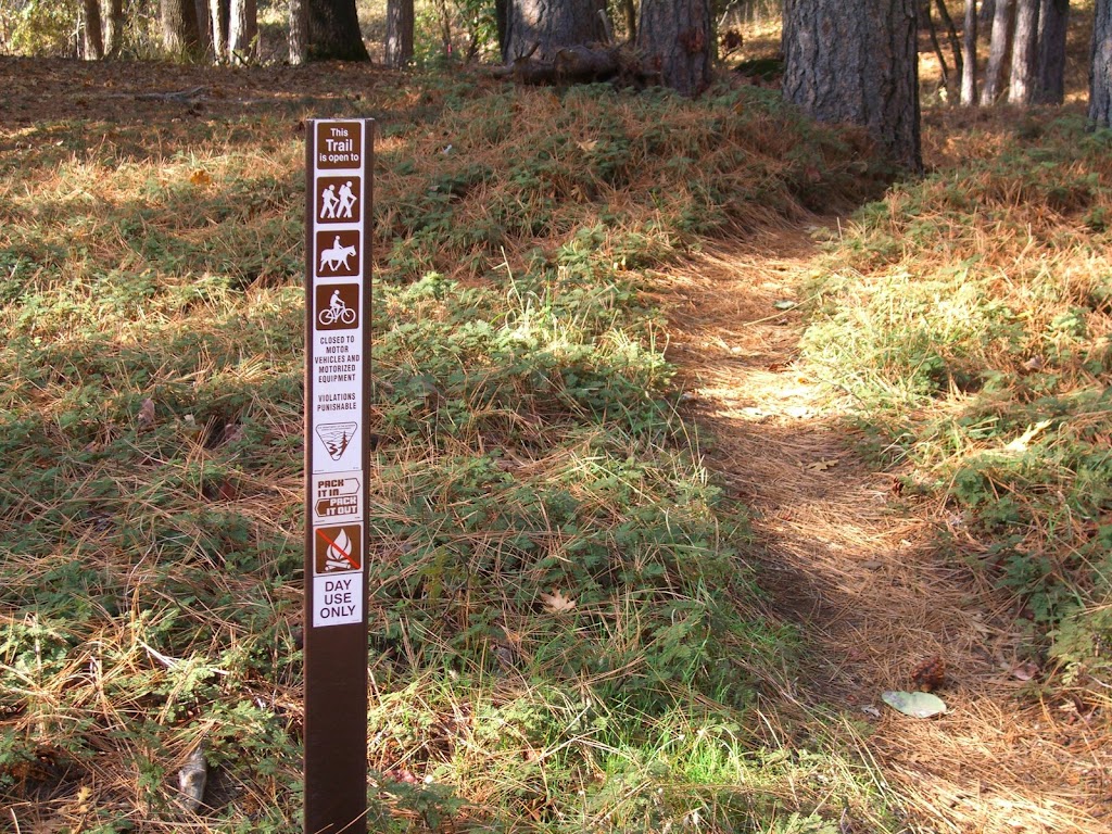
Images of Round Mountain No-Moto Signs

On our ride yesterday, I snapped a few pictures of the new no-moto signs on Round Mountain. They look great and are well placed at trailheads in the area.

For some reason, I find the creation and installation of these signs to be very gratifying. BONC is all about cooperation and promoting and saving trails. The sign project involved lots of cooperation with the Round Mountain community and the BLM to help stop trail damage from mindless motoheads.

Thursday, December 13, 2007

FDLT Trailwork

From FATRAC:

We have trailwork scheduled for December 16th on one of the area's favorite trails. Do you enjoy FDLT? Come out and make it better!

Sunday December 16th, 2007
Description: Come out and help us clean our trail. Contact the trailwork coordinator to confirm if chance of rain.

Meeting Location: Grizzly_Bear_House
Meeting Time: 9:00:00 AM
Leader: Ron Dickenson

Tuesday, December 11, 2007

Round Mountain No Moto Signs are Up

The BLM tells us that they have erected no-moto signs at all important trail heads on Round Mountain! Yewhooo! This came about because of a BONC request about a year ago. Hopefully, this will deter at least some moto riders from poaching this area.

This project also has the nice side effect of engendering good will between BONC and the Round Mountain community.

Monday, November 26, 2007

More Fun on the Sandusky Trail

Alison sends us some details on the upcoming Sandusky trail building extravaganza:

"Dates: Friday, November 30th - Tuesday, December 4th, Weather permitting.

Scope: Work is proposed to commence Friday morning from three points on the remainder of the unfinished section of the Sandusky Trail. Access to these starting locations will be from the Ridge Road Trail Head. This is approx. 3 miles past the Forest City "mountain house road" turnoff on Ridge Road. Trail head will be flagged with vehicles parked along road."

No idea when the trailwork begins though. Alison? Zachi?

Tuesday, November 13, 2007

Trail Building at the Old Airport

Word is that about ten people helped out to build and improve trails at the old Nevada City airport last week. The effort was head up by Debra Little and featured the talents of the Miners high school team. I have not made it up to the airport to check out the work, but Debra tells me that they finished everything they intended to get done.

Trails so close to town are super important. They represent recreational opportunities for everyone without requiring a long car trip to access them.

Wednesday, October 31, 2007

Narrow Gauge/Tressel Trail Work Day - Sunday, 11/4

From the GCTC: Due to forecasted inclement weather, this work day has been rescheduled to Sunday, November 4. Questions? Please contact Melissa at 530.268.1378

Volunteers needed to complete this important project! This is the last workday of the year and your last chance to come out and make a difference on our trails.

When? Sunday, Saturday, October 20, 2007
Time? Meet at Skillman Campground (13 miles east of Nevada City off Highway 20) at 9 a.m. We will carpool from Skillman to the work site and be finished by 1 p.m.

Why? We will be completing the re-route of the Narrow Gauge/Tressel Trail. Please bring loppers, rakes and shovels. Bring drinking water and a lunch.

Per Forest Service requirements, long sleeve shirts and pants and close-toed shoes are required; please wear gloves. Hope to see you there!