Tuesday, April 22, 2008

Bullard's Trail Day - 5/10

Join us for a trailwork day on Saturday, May 10th at Bullard's Bar. Meet at 9AM @ the USFS Yuba River Ranger Station at the corner of Highway 49 and Marysville Road. Map.

We will work to improve BONC-adopted trails in the area. We will also lead a group of college students who have volunteered to pitch in. Please bring gloves, long pants and shirts, water and insect repellent. See you there!

Monday, April 21, 2008

Trailwork Near Lone Grave

From the Gold Country Trails Council:

There will be a club-sponsored BBQ after the trail work day! A great time for trail volunteers to socialize and get to know one another!

When? Saturday, April 26, 2008

Time? Meet at the Gold Country Equestrian Trailhead staging area (off of Conservation Road off of Highway 20) at 8:45 a.m. Be ready to carpool to the work locations. Work will be completed in approximately 3 hours.

Why? We will be providing general trail maintenance on local trails.

Please bring rakes, shovels, loppers and handsaws. GCTC will provide additional trail tools. Please bring a chair and drinking water. Per Forest Service requirements, long sleeve shirts and pants and close-toed shoes are required; please wear gloves. If you're planning on attending, please call Willie and Sue Brusin at 530.265.4018.

Thursday, April 17, 2008

Haire-o-thon!

Bill and Mike Haire have cut in an entire section of the Loma Rica Trail. If you drive by, this trail is just below eyesight on the north side of Brunswick Road near the Nevada County Horseman's area entrance. Plans for a bridge over Wolf Creek are moving along.

See a map of the entire proposed trail (PDF).

Please thank Bill and Mike if you see them. Mike spent a big chunk of his vacation time building this new trail for everybody.

Wednesday, April 16, 2008

Prescribed Burns @ Bullard's

From the USFS:

"The U.S. Forest Service, Tahoe National Forest, Yuba River Ranger District is planning to start the Bullards Bar Prescribed Fire Project today. This project includes approximately 70 acres of underburning at Vista Point, north of Marysville Road, in Yuba County.

Dependent upon favorable weather and air quality conditions, the district hopes to complete the project this spring. Goals include reducing hazardous fuels, habitat improvement, and reintroducing fire as a natural ecological process.

The legal locations for the project are T18N, R7E, sections 24. If you have any questions about this project please contact Mike Cherry, District Fire Management Officer or Janet Cowell, District Fuels Officer at 530-288-3231."

Iron Mike

Yesterday afternoon, while driving my kids to back from school, I passed Mike Haire as toiled away on the new Loma Rica Trail off Brunswick Road. There he was all alone, digging away with his Pulaski, forging a new trail for the rest of us.

I hurled some insults at him as I drove by, but he was oblivious to my harrassment. Mike did all this work after he rode the Missouri Bar/South Yuba loop, as he related in an email. So he put in 17+ miles of riding and 2.5 hours of solo trailwork in one day. Henceforth, Metal Mile will be known as Iron Mike.

BTW, Iron Mike tells us that the poison oak is prevalent on the South Yuba/Missouri Bar Trails. This matches my experience on local trails of late.

Tuesday, April 15, 2008

Loma Rica Trail

Some new trail construction garners a lot of attention, while others progress quietly along. The latter best describes the Loma Rica trail project. Bill and Mike Haire have worked hard on this new trail and are making steady progress.

The proposed version of this trail (pdf map) would connect Empire Mine to Brunswick Basin along the Brunswick Road corridor. In effect, this connects trails from near downtown Grass Valley (Memorial Park) all the way to Town Talk Road.

Bill and Mike could use some additional volunteers. Call Bill at the Nevada County Land Trust: 530.272.5997.

Wednesday, April 09, 2008

Empire Mine Trails Update

If you are like me, you miss the trails that have been temporarily closed at Empire Mine SHP. The good news is that State Parks plans to open new and better singletrack in the park (imagine that). I checked in with Superintendent Ron Munson and this is what he had to say:

"Cultural survey work for the Osborn Trails Mitigated Neg. Dec.(MND) has been completed by Sonoma State Univ. Spring biological surveys are in progress right now by our own N. Service Center staff. So the CEQA review process is on track, and we still expect to begin the implementation of the Osborn trail reroutes and upgrades this fall (Oct?), in keeping with proposals generated from our public meeting."

Basically this means that we will can hope to see some trail openings toward the end of this year or early next year. Of course, you should add alway add six months to my optimistic estimates :-)

Epic Event: Donner Lake Rim Trail

A Donner Lake Rim Trail epic-like celebration is planned for the weekend of August 8th through 10th. BONC will join FATRAC, ROMP, Mountain Bikers of Santa Cruz (MBOSC) and others as we participate in a bunch of fantastic riding and build another sweet section of the Donner Lake Rim Trail.

Please mark your calendars, as this will be a great weekend of fun. Cost is free, more details coming. I've reserved group camp sites for BONC at Donner Memorial State Park.

Thursday, April 03, 2008

IMBA Trail Care Crew Coming

The IMBA Trail Care Crew will visit Grass Valley and Nevada City on November 22-23. The visit will focus on one or more of the following:

Diamond Arrow Trail
Hirschman's Pond
Miner's Trail

If you have not participated in a Trail Care Crew event, they are super fun and rewarding. Please mark your calendar or use the Nevada County Cyclists Calendar.

Monday, March 24, 2008

More from the Tahoe National Forest

From Joe Chavez:

"Due to scheduled helicopter logging activity along and adjacent to the South Yuba Canal near the Burlington trail system, the Forest Service will be implementing a Forest Order to close the area 300 feet south of highway 20 and south of the 20-12 Road (Burlington Ridge Road).

The logging needs to happen during the scheduled dewatering of the canal starting April 14. The closure would be scheduled from April 14, 2008 through June 1, 2008. It is hoped that the need for the closure will only be three weeks, but the extra time is added just in case don't go as planned. Because of the need to complete the activity in three weeks, and due to the costs involved, the loggers will be working seven days a week. As soon as the helicopter
logging is done, the closure order will be lifted. The Memorial Day recreation event will still happen, regardless of their schedule, as we will require them not to fly during the days of the event (if they are still in the area by then).

I know this will be extremely inconvenient as the trails will just be opening up at that time. But, I hope that you can understand the safety need to not allow people to be underneath flying logs and falling limbs. The helicopters will be all over the place when they start the logging. The Pioneer Trail, Hallelujah Trail and Omega trail east of the staging area (can access the Steephallow area north of Highway 20) will remain available and open. Sorry about this inconvenience. Joe"

Downieville Shuttles

There is some controversy as to Downieville shuttle usage and new USFS fees. Joe Chavez of the Tahoe National Forest wrote me this morning and had this to say:

"Certainly the discussion is distorted. The reality is that in 2004 the Forest Service, nation wide, has changed its regulations to close the loophole that commercial businesses used to run shuttles and guiding when they only used Forest Service roads or trails, without having to be under permit. Now these commercial operations, like all other commercial operations using National Forest Lands, are also required to be under permit. We are not curtailing their business, in fact I have asked each shop to give me their past numbers over the last six years to set the capacity of shuttles to Pack Saddle at a level that reflects their highest use year's numbers. They would be required to pay a fee of 3% of their gross ($0.45 added to a shuttle fee of $15, or $1.80 added to a bike rental of $60) for the permit. This is part of the national policy that all commercial users benefiting from use of the National Forest must pay a fee.

There is nothing personal about putting the two shops under permit, it is our national policy. Based on user conflicts and trail impacts, the Forest Service would have the option to restrict their use numbers, but we are not proposing this because we do understand the importance of this economic engine to Downieville. The Forest Service also requires being additionally insured to protect the public's liability. Other areas, like the Forest Service in Moab, implemented the permit requirement back in 2004.

Appreciate any objectivity and reality you can shed on the issue with the community, thanks. Joe"

Monday, March 03, 2008

Killer Trailwork on Round Mountain

Yesterday was a great day for BONC. On the Rock Creek Flume Trail, we built fantastic re-routes that will be hella fun to ride, restored a masticated section, built up some erosion control features and completed it all in one outing. All on a gorgeous 60+ degree sunny day.

The re-routes involved blazing through lots of manzanita with chainsaws and hand tools, cutting new trail and building Zachi's extremely cool bermed switchbacks. The singletrack restoration up above was about clearing debris and restoring the trail. I thank all of the 12 volunteers who showed up and you should too. I am as proud of this project as any trailwork I've done with this club. In fact, after the trailwork, I drove back out to Round Mountain again to show Shannon our work and take pictures.

The new sections will be a bit loose and duffy until we see some wet weather, so please ride gently.

Big thanks to:

The Salvation Army, who allowed this project to occur on their private property.
Hyland Fisher, who coordinated with the SA.
Bill Haire, who plotted the re-routes.

Wednesday, February 27, 2008

Reroutes

Yesterday, Hyland and I met with management of the Camp Del Oro, which owns some of the land on which the Rock Creek Flume Trail crosses. We agreed to re-route two sections near the trailhead on Rector Road. One is just above the road and the other is a deeply rutted section a hundred yards or so above the first section. This work will make these sections more fun to ride and much more sustainable. We'll also clear a section of the trail of debris from a recent thinning operation.

Meet at the Forest Service office at 631 Coyote Street, Nevada City, at 10:00 am. If you have loppers or folding saws, please bring them.

Wednesday, February 20, 2008

Big Trees Taken Out at Bullard's

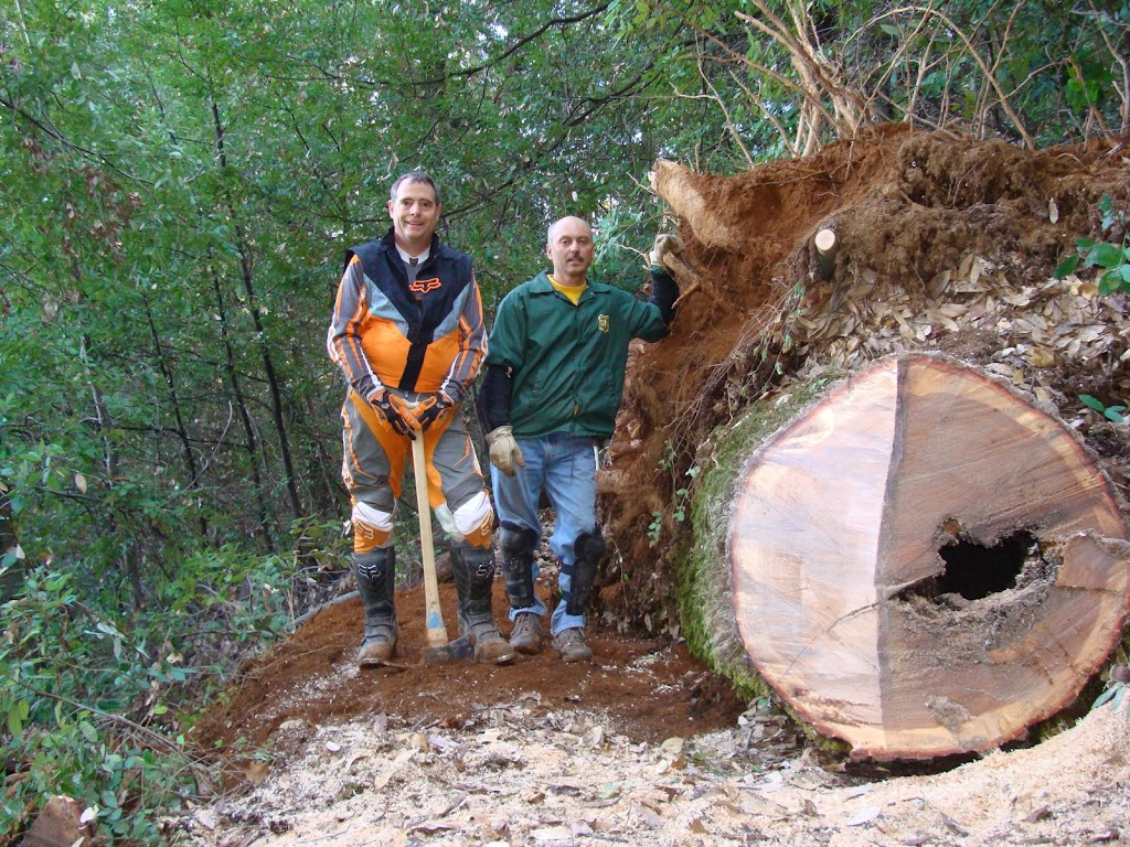
Thanks to the efforts of the Tahoe National Forest staff and volunteer groups like BONC and SBTS, the Bullard's Bar trail system is kept in excellent condition. Even if it mean taking out big fallen trees. And I mean *big*.

Look at these pictures taken at Bullard's after recent storms. This was part of an effort that removed 30 fallen trees from these trails! We should all thank Joe Chavez of the USFS and every volunteer who works with him.

Tuesday, February 19, 2008

Round Mountain Trailwork Day, 3/2

Join BONC for trail work on Round Mountain on Sunday, March 2nd, 2008.

1. We will be installing culverts in two locations where a creek crosses the trail and perhaps implementing some additional erosion control features.

2. We will be cleaning up the Flume trail near Rector Road. The property that this trail is on was recently cleared for fire abatement and the trail has been lost under the leftover plant material. We have been given permission from the property owner to do this work.

Meet at the Forest Service office at 631 Coyote Street, Nevada City, at 10:00 am

We will have food, drinks, beer and maybe even some free schwag! Rain or bad weather cancels the culvert work; call 274-DIRT if things looks iffy.

Wednesday, February 13, 2008

Try the Divide Ride

New to mountain biking? The Try the Divide Ride event is for you. From the FATRAC website:
Every third Saturday FATRAC will be doing a combination ride from the picnic table at the top of the Forest Hill Divide Loop Trail which will include food and drinks at the finish. Three rides will begin at the same location.

A beginner/novice ride will be an out-and-back ride along the most accessible part of the FDLT as far as the riders are comfortable (probably 5 miles total). An intermediate ride will do one loop around the entire FDLT (12 miles). The advanced option will include FDLT, the Connector, go to the Confluence and possibly Stagecoach/Manzanita/Flood, depending on rider preference (between 18 and 32 miles). You decide which ride you want to participate in.

Register here.

Tuesday, February 12, 2008

Osborne Hill News

Today's Union brings us news that developers have pulled the Osborne Hill timber harvest plan (THP) that would have devastated trails on Osborne Hill. Great news!

Thank you to the CDF for listening to neighbor's concerns about this ridiculous logging proposal. We'll have to remain vigilant about this issue, as this trail inventory is important. I am hoping that we can create a win for everyone involved: trail users, State Parks and yes the developers.

Friday, February 08, 2008

Coming Soon: 14 Miles of New Singletrack

This week, the Auburn Journal reported that dirt will soon be turned for the creation of the North Fork Trail in Auburn. This was confirmed to me by a source close to State Parks.

The article does not mention, however, threatened legal action by those opposed to the trail. A few malcontents have made noise that this non-motorized trail might spoil the splendor of the area. I wonder how these people know that this area is so splendid. Perhaps by hiking off trail illegally and trampling the unspoiled area?

In any case, the trail will be fantastic. It will provide a whole new riding option from the Confluence area. You can ride up Clementine until you reach the split off for this new trail, where you can ride out 14 miles to Ponderosa Bridge and back. I know there is one trail/fireroad that climbs up from the new trail that will get you near Fuel Break, but I cannot recall its name. Perhaps it is the Lake Clementine Access Trail (PDF)?

Saturday, February 02, 2008

BONC Potluck Postponed

Because of this unusual weather, tonight's BONC meeting is postponed. We'll have a new date for this event ASAP.

Go drink some hot chocolate.

Friday, February 01, 2008

Osborne Hill - Some Progress

The CDF has responded with to the Timber Harvest Plan (THP) submitted for Osborne Hill and their comments are very favorable for the cause of trail users. Essentially, the CDF found that the plan was riddled with inaccuracies and misinformation regarding everything from toxic substances to logging techniques. Most importantly for us, the CDF specifically called out the importance of trails on the property and how the THP does not address how trail usage would be affected by the logging.

The CDF suggested that the logging proponent withdraw the plan. While this sounds like a victory, who knows if the logging proponents will abide by these suggestions and withdraw the THP or just submit another half-baked proposal in the future. They seem just about as hard headed and clueless as they have all along.