Wednesday, October 01, 2008

BONCers and the New King Range Trail

BONCers Jim and Cathy Haagen-Smit were honored at the dedication ceremony for this new Paradise Royale Trail in the King Range. I can't wait to ride it! Read the story.

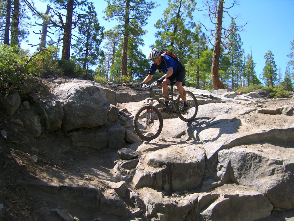
Word is that this trail offers something for every level of rider, from smooth sections, to rocky technical parts that require trials skills. I am also curious to know what building techniques volunteers used to deal with the incredible amount of rainfall the King Range gets.

Tuesday, September 23, 2008

Take a Kid Mountain Biking Day - Empire Mine

BONC will host our own Take a Kid Mountain Biking Day on Saturday, 10/4 at 9AM.

We will lead a few rides for big and little ones from Penn Gate at Empire Mine starting at 9AM. Kids five years and older are welcome, all the way up to high schoolers. We have rides for everyone, plus snacks and give-a-ways. All riders must sign a waiver form, wear a helmet and bring a bike.

Please mark your calendar. We still could use need some additional volunteers and non-cash donations. This will be a great time!

Tuesday, September 16, 2008

Pioneer Singletrack Conversion

Please join us as we convert Pioneer fireroad into singletrack as it descends into Bear Valley:-)

TWO DATES:
October 11th from 9am till 1pm (free lunch provided at 1:30pm)
October 12th from 9am till 1pm (bring your own lunch, water)

Camping is available Friday and Saturday nights at the Diamond Creek parking area. No running water at this site. RVs and trailers are OK. Meet at the Excelsior Road at Highway 20. A short distance down this road will be our meeting place for both days. Please wear long pants and hiking/work shoes and gloves. If you would have any of the following tools would be of help to bring: loppers, pruners, shovels, steel rakes and/or McClouds.

This is a joint project with the USFS, Gold Country Trails Council, Nevada County Woods Riders and BONC, so it is *super important that we have good mountain bike representation*.

Wednesday, September 10, 2008

Meeting with the Horse Folk

As you can see from yesterday's post, I had a great meeting with the Gold Country Trails Council last night (view the slides). We spoke about sharing trails and unifying our efforts. The presentation was well received.

I promised attendees that I would share some of the comments equestrians made about local mountain bikers with BONC membership. These included:
  • Equestrians find that the vast majority of local mountain bikers are extremely considerate and courteous on the trail. Even if a cyclist rides inappropriately, he or she is receptive to constructive criticism from equestrians on the trail.
  • No one wants to replicate the culture of user animosity and conflict that is so dominant on Bay Area trails. We have something very special here that is worth preserving.
  • Horses are prey animals. Thus they react quickly if a hiker or cyclists suddenly appears from behind a tree. Because of this, please announce yourself, talk and make some noise when you approach a horse.
  • When riding on a trail that cuts across a slope, it is best to ride on the down side of the animal.
  • GCTC equestrians try to avoid wet trails because they leave hoof holes and such trail conditionals are stressful on the horses legs.
GCTC is working very hard on many of the USFS trails that we ride and enjoy. It is crucial that we continue to work with them and support their efforts as much as possible.

Sharing Trails

I made the following presentation to the Gold Country Trails Council last night:

Tuesday, September 02, 2008

Wrapping Up the Forest City Bridge

From Zachi Anderson:

"The bridge project is pretty much done. We have to attach the handrail but every thing else is now done. In the picture below you can see the pearl necklace that Jon Fisher is walking back on. It descends from the embankment above for a sweet trials run. The entrance to the pearl is 60 feet farther back up the trail with a filter at the beginning. The employed concept is that the route to the trials section has to be a clearly less traveled secondary trail (12” wide) and not the primary trail (36”wide). The filter is a technical section (in this case a 16” rock step up) that has to be negotiated to access the main trails section. The entrance is prepositioned to eliminate impulsive uninformed attempts. You must have ridden the main trail to see the option first. It is all very stable boulders that are sustainable (no rot) and all hardened surfaces over 10%.

BIG thanks to all the people that have helped. Jon Fisher and Tom Ernest especially for their high volume of participation and personal investment. We will line up another fun weekend to ride this baby when we throw in the hand rail."


A big thanks indeed!

Wednesday, August 27, 2008

Trail Riding on Multi-Use Trails

I'll be speaking at the Gold Country Trails Council on September 9th @ 7PM at the Golden Empire Grange Hall. The topic will be "Trail Riding on Multi-Use Trails", but I plan to use the opportunity to dialog with the local equestrian community.

It would be great if other local bikers join join in. Our positive relationship with local equestrians is one of our most valuable assets and one that is envied statewide.

11283 Grange Ct. Grass Valley, CA - Map

Monday, August 25, 2008

Tahoe National Forest Trail Update

From Joe Chavez of the Tahoe National Service:

"This is just FYI on some recent trail work, so you will be aware of the changes.


Empire Creek Trail - The two climbing turns installed last fall by No-Toil group and SBTS have been hardened with turf stones. Soils are ashy here and will never firm up (like the west end of Chimney Rock Trail). The reroute of the switchback above these climbing turns has been completed. The trail now makes a large sweeping turn, putting you out on the ridge at a nice vista point. Bottom end of the Empire Creek trail (steep section right off the road), this area has been lengthened to lower the grade (expect new turns). Wet springs, my one remaining trail crew member is currently working on draining the springs off the trail along the lower end of the trail. There will be deeper rolling dips supported by rock on the reverse grade (expect larger, more abrupt dips - slow down).

Lindsey Lakes Trail - Just below the intersection with Crooked Lakes Trail (near Rock Lake), the first section of the Lindsey Lakes trail reroute project to lower the grade is done. The trail now contours over to a vista point and returns to the old trail in the dry meadow. (only several hundred feet of the original trail has been rerouted, there is still much more to do on this reroute project)

Excelsior Trail - Last remaining section of reroute identified in the Burlington EIS has been completed (40 foot hill climb section in the plantation). The trail now contours in and out of the drainage.

Gibraltar Trail (single track) - We started to reroute the very steep section of trail immediately out of Dean's Ravine heading north. We expect to finish this piece of reroute the week of Sept 1, when I have a chance to get back there. We already contoured across the steep slope to a point that we know it is feasible. The reroute goes across the steep sidehill, then turns back where miners created a "gut," then it will reconnect back to the old trail above the steep section."

Wednesday, August 20, 2008

North Fork Trail Vote

From FATRAC:

"Write an email or attend a hearing to support the NORTH FORK TRAIL!

On Aug. 26, 2008, at 8:35 a.m., the Placer County Board of Supervisors will be meeting to consider certifying the Final EIR & approving the North Fork Trail along the American River - in the board chambers at 175 Fulweiler, Auburn.

We WANT the Board to do this so we can FINALLY see construction getting underway on this long-awaited new trail. If you can attend the hearing, great! OR please take 2 minutes NOW to write a short email to your supervisor to ask him to approve this new trail. Please!


Here's the email address for the Board of Supervisors: bos@placer.ca.gov.

Subject line: North Fork Trail Project.
[Contact Jim Haagen-Smit if you have any questions at (916) 663-4626.]


Talking points:
  • The trail will be environmentally sound by design.
  • What better way to get folks to appreciate nature than by providing a simple trail to access it.
  • With high gas prices more & more families are looking for affordable ways to recreate near home.
  • A healthier community saves money by dealing with costly health problems associated with obesity.
  • Volunteers helped build trails in the area; the community likes to give back by supporting these kinds of projects."

Monday, August 18, 2008

Steering Committee Kickoff

Last night, the new BONC steering committee conducted our first formal meeting at Twin Cities Church. We discussed some great ideas, assigned tasks to committee members and talked about where BONC is and where we need to get to. A big theme that emerged from the evening is how BONC needs to embrace more fun: more fun rides and more fun events. Nevada County has many mountain bikers, but only a relative few participate in BONC activities. We aim to change all that.

I am certain we will see some related innovative club initiatives soon. If you are interested in serving on this committee, please let me know.

Thursday, August 14, 2008

Tahoe Donner Event - Recap

Last weekend, over sixty NorCal mountain bikers convened near Donner Summit this week to build some new singletrack and ride many, many miles of primo Sierra trail. Participating clubs included BONC, FATRAC, BTCEB, MBOSC and ROMP. Sponsors included New Belgium, who contributed free cases of their finest brews.

From Wednesday through Sunday, we rode countless group ride on the Tahoe Rim Trail, Hole-in-the-Ground, Donner Lake Rim Trail, Sawtooth Trail and many others. We camped out at Donner Lake State Historic Park, with access to beaches, showers and BBQs. On Saturday, we all pitched in to clear brush for a new section of the Donner Lake Rim Trail high above the lake near Tahoe Donner. This will be a gorgeous section that towers at 7500' with sweeping views of the area. These vistas and great weather kept us inspired as we trimmed back vegetation for the new trailbed.

It was a big success, but it sure would have been better to see some more local representation from BONC and SERT. We hope to make this an annual event, as it was soooo much fun this year! Pictures and videos.

Monday, August 11, 2008

Forest City Trail Fun

The Forest City folks are staging trailwork on weekend of the 25th.  They hope to put the last touches on the bridge and to prune out the Plum Valley Ditch Trail. On Labor Day weekend, the group will host rides all weekend. Camping, BBQ music and other fun (bike polo).  Ribbon cutting for the bridge etc.

Please consider joining these great events.

Saturday, August 02, 2008

Pruning Bullard's

We had a modest turnout for today's trailwork at Bullard's, but six of us managed to trim back all the overgrowth on Rebel Ridge and some on Bullard's Bar Trail. I am really excited that Rebel Ridge is finally clear of the nasty overgrowth that made it unpleasant to ride, especially on the south side of Marysville Road.

Note that there are a few downed trees (as usual) on Bullard's Bar Trail between Rebel Ridge and Schoolhouse Trails. Hopefully we can take these out soon; they are somewhat small.

The advantage of the shorter trailwork session was that we were able to get in a fun ride (i.e. not while nackered) on this trail system after we wrapped up our work. Bullard's is a great place to ride on a hot day because there is so much shade.

Big thanks to Fred Bergman who spearheaded and coordinated this project! And others who came to Bullard's recently to help improve trail conditions. Bullard's is a high maintenance system, but is so worth it.

Monday, July 28, 2008

Illegal Round Mountain Activity

Word is that some trouble has brewed on Round Mountain. One resident reports:

"There are now 2 fire areas at Coyote Lookout- one very recent, both ugly. Fires, firearms trash and paint ball trash have recently appeared on Moonlight (across from Coyote Parking).

The road sign at Hudson & Rock Creek is missing- making emergency response more difficult in the neighborhood. There have been several BLM "Day Use / No Fires" signs vandalized this summer.

The Round Mountain Planning area is a Day Use Only and a No Fire area. Motor bikes and other motor vehicles are required to remain on roads."

I've asked BONC members to keep an eye out and report any such activities. One member suggested carrying a camera to document the damage and take pictures of violators if possible. I believe that the BLM has a new enforcement officer for this area:

SCHERTELL, Jody
Ranger (Grass Valley)
(916) 985-4474

Wednesday, July 23, 2008

Where Can I Ride?

As president of BONC, I get this question a lot. The good news is that there are many answers on the award-winning BONC trail guide page. It has lots of links to external resources and Google Earth (KML) files that describe excellent area rides.

Got a suggestion for a map for this page? Have a KML file you would like to share? Just let me know and it is as good as posted.

Tuesday, July 22, 2008

Forest Update

Zachi provides this very interesting update from Forest City:

"This weekend is the last weekend of the month. For the rest of the summer, we will be having our gatherings and rides on the last weekend of the month.

Although people may continue to meet for projects and rides on other weekends, our goal is to plan a weekend a month that everyone can hangout together and share goodtimes and progress on their various interests.

July has been a busy month. Here are is a review of some of the projects."

"This month we also finished rough flagging in the new Ridge Runner Trail and the Jersey Trail. This will be a dynamic new downhill or uphill climb from FC to the top of the ridge. It features new curving trail layout that is less linear in nature and some fun features you can find on your own.

We also did quite a bit of scouting this month. We found a connector to the lower Truckee Ditch which creates a route from Miller Ranch all the way to the Goodyears Bar Overlook. This is a critical connector to the bullards bar trail system. The final 3 miles of the Plum Valley Ditch were scouted. This is also a critical connector to Bullards Bar. When opened this will make the trail 10 miles long! And the old Downieville Trail was tracked entering FC from NC and departing toward Downieville.

Lastly we have the Sandusky Bridge. A huge project that is almost done. This stone bridge boasts a 20 foot arched span and a trail deck that warps through the area like a gliding hawk.
This weekend we hope to top out the bridge with the curbing and finish the approach.


SO, Lots to celebrate. Please consider bringing up some friends for some fun riding and camping. We will be up from Thursday – Sunday. Generally there is a BBQ Saturday night and a ride Sunday."

Monday, July 21, 2008

Bullard's Bonanza - 8/2

BONC is going to mix it up a bit for our next trail day at Bullard's. We'll have a shorter volunteer session (9AM - noon), with some killer riding afterwards. BONC will provide free beer and snacks. Join us on Saturday, August 2nd at Bullard's Bar. Meet at 9AM @ the USFS Yuba River Ranger Station at the corner of Highway 49 and Marysville Road. Map.

We will work to improve BONC-adopted trails in the area. Please bring gloves, long pants and shirts, water and insect repellent. See you there!

Tuesday, July 08, 2008

Bridge Building in Forest City

Zachi and company continue to put in many hours of skilled work into the new bridge at Forest City. From Zachi:

"We had a fantastic last weekend.  Lots got done.   The new Jersey Ravine Trail has gotten flagged in.  And excellent work on the bridge.   Here are a few photos!  Please come up and play.  Water is almost stopped at the creek.  This is the last few weekends to bang this out!"

"Dates upcoming…  Last weekend of every month, ride and projects.  Aug 16th, 30 mile ride event and BBQ with artshow in town and music."

"Thanks to all that came up, 14 in all.  Look forward to finishing this up."


Thursday, July 03, 2008

Pioneer Trail Closure

According to the USFS, the Pioneer Trail will be closed due to brush mastication work on Wednesday (7/9) between Skillman campground and the Equestrian Staging Area.

Consider using the Hallelujah Trail as an alternate route. The contractor is aware of the trail and the Hallelujah Trail will be buffered (protected).

Tuesday, July 01, 2008

New Trailwork Reporting Tool

BONC has a new tool for tracking trailwork hours. Using Google Docs, I've created an online form whereby BONCers can report donated hours on an honor system.

Please use this to report ANY trailwork you donated, even if it happened mid-ride. This tool will allow BONC to:
  • Award our volunteers (think swag)
  • Plan future trailwork
  • Apply for grants
  • Use aggregate trailwork statistics for advocacy
Note that information entered in this form is only accessible by members of the BONC steering committee.