Thursday, June 24, 2010

Partial Closure of the Wetherall Trail

The Nevada County Land Trust is temporarily closing a portion of the Wetherall Trail to accommodate neighbors concerns about use of the private Big Blue Road. The Land Trust will temporarily close the trail at a point some 200-300 feet above the point where it joins the NID service road. A barrier will be installed and signs will advise users that this point is the end of the trail and that users should return to the Cascade Canal rather than continuing on down to Big Blue Road or the D-S Canal.

Please abide by this closure. The Land Trust intends to build a return trail that will connect with the new trail and bring trail users back to the top of the preserve property via a different route along the eastern portion of the property. This work is being planned for this fall, and will provide another opportunity for volunteers to assist in the trail construction.

Building trails is complex process that the Land Trust does exceptionally well. Let's support them as they work through this.

Wednesday, June 23, 2010

BONC BoD Meeting

Please join us for the next BONC board meeting! Meet at the open cafe area behind SummerThymes off Highway 174, across the street from Memorial Park @ 5:30PM on June 27th.

Come find out what the club is focusing on and how we plan to achieve better mountain biking opportunities in Nevada County. We'll have updates on the South Yuba Ridge, Grouse Ridge, Scott's Drop and Diamond Arrow trail projects and discuss future riding, social and trailbuilding events, including the IMBA Trailcare Crew visit later this year. Whew, there is a lot going on!

I am hoping some of us can ride the Mine afterwards. See you there.

Wednesday, June 16, 2010

Jon and the NCLT

Jon Fisher has worked on many trails in our area. You might not know this because Jon is not the kind of guy who grandstands. For years he has quietly worked alongside Bill Haire and others creating great local dirt routes using his equipment. You may have seen his work on the Empire-to-Memorial-Park trail and other Land Trust projects.

Last weekend, Jon worked with Bill on the trail from near Twin Cities Church to A-to-Z on Ridge Road. This project may not be about creating the next big freeride drop or swoopy singletrack, but trails which offer connectivity like this are very important. They create transportation corridors and the means to avoid dangerous motorized roads when hiking or riding locally.

As someone who rides more local routes these days (having three kids will do that to you), I appreciate Jon's efforts. His work is yet another reason we need to support the Nevada County Land Trust as the primary trail building organization in our area. We are lucky to have Bill, Jon and other NCLT people creating trails for all of us. It is not easy establishing permanent trail easements with local governments and property owners. I know that from personal experience that turning dirt is least complicated part of creating a trail. But such local trails make our area a much better place to live. No one does it as well as the Nevada County Land Trust.

Wednesday, June 02, 2010

National Trails Day Events - Sat. 6/5

This Saturday, there will be a local celebration of trails. If you can't join BONC's Gala ride, be sure to check out the other activities.

Perhaps most exciting to me is the dedication of the new trail in Woodpecker Preserve on Banner Mountain. It will be a great day!

Tuesday, May 25, 2010

Tahoe Trail Event 2010

Join us for our annual Tahoe weekend of camping, riding and trailwork on August 14-16, 2010.

BONC will join FATRAC, MBOSC, ROMP, and other Northern California mountain bike clubs for our annual Tahoe multi-club campout, which will include rides, a half day of trailwork, movie night, a raffle, and hanging out with other mountain bikers from all over Northern California. We'll camp at Zephyr Cove campground on the east side of Lake Tahoe. This is a walk-in campground, so your car may be a few hundred feet from where we will camp. We'll partner with the Tahoe Rim Trail Association to reroute a section of the Tahoe Rim Trail at Kingsbury Grade.

There will be many rides, mostly around the east shore and south shore of Lake Tahoe. BONC will ask for a $10.00 donation to help us to reserve your spot. Please let me know if you plan to join us.

August 14th - 16th 2010
Zephyr Cove Campground (east side of Lake Tahoe)

This event is a great time!

Monday, May 24, 2010

Hirschman Pond and the Mini-Excavator

Today, I spoke with Bill Haire regarding the Hirschman Pond trail project in Nevada City. I was pleased to learn that trail construction is underway. Bob Hale is building the trail with his mini-excavator, which is great news. Bob and his brother have built trails in this area for decades. Along with others, they built the North Yuba trail from Indian Valley to Goodyear's Bar, which is an outstanding piece of singletrack.

I can't wait to ride this new trail, but everyone should know that the trail is still under construction and not open for public use at this time.

Wednesday, May 19, 2010

Country Trails Plan Vote June 8th

A reminder that an important hearing for the Western Nevada County Non-Motorized Recreational Trails Master Plan is coming soon. From Larkyn Feiler:

"The tentative date scheduled for the Board of Supervisors to consider adoption of the Trails Plan is June 8, 2010 at 1:30 pm in the Board Chambers of the Eric Rood Administrative Center.

This public hearing is very important for the outcome of the Trails Plan and we encourage you to attend the meeting and participate in the public comment period or provide comments in writing prior to the meeting if you are unable to attend."

Send messages to:

Larkyn Feiler
Advance Planning Division
Nevada County CDA
950 Maidu Avenue, Suite 170
Nevada City, CA 95959

Tuesday, May 11, 2010

Ride on National Trails Day - Sat. 6/5

Join BONC as we celebrate National Trails Day with the Nevada County Land Trust and other supporting organizations on Saturday, June 5th. We'll host a ride for two levels of riders:

Beginner: Ride around Nevada City on local trails
Intermediate/Advanced: Ride up on trails in the Highway 20 corridor

Both meet at Stonehouse Parking Lot at 9:30AM. Afterwards, we'll join the the National Trails Day event from 12-1:30 at the Stonehouse parking lot. This is always an inspiring event, so even if you cannot join the ride, be sure to stop by for the festivities.

Loma Rica Ranch Race

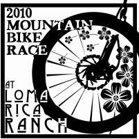
In case you have not heard, there is a bike race or two this weekend :-) One is on pavement and involves guys named Levi, Larry... or is it Lance? Whatever. Anyway, the first race is on Saturday at Loma Rica Ranch and it is a big deal!

A lot of volunteers have put in a lot of hours to build the trails for this course. Trails were create via under YBONC's Trail Stewardship Program of teen club members, parents, contractors, and local non-profit volunteers. A big thanks to everyone who chipped in, especially Jet Lowe, the tireless leader of YBONC!

To support this event, please consider racing or donating to YBONC.

Round Mountain Trailwork- 6/12

Join BONC for trailwork on Round Mountain on Saturday, June 12. We'll install some culverts, improve drainage and tackle additional important tasks. Meet @ 10AM just off Rock Creek Road (map).

Please join us. We'll offer food and drinks for participants. Please bring long pants, shoes and gloves. Some of us may ride afterwards.

Tuesday, April 27, 2010

BONC, Bullards and BBQ! - Saturday 5/9

Join BONC for a Gala Ride at Bullards Bar on Saturday May 8th. Meet at Vista Point (see map) at 1PM. If you want to carpool, please meet at Uren Street and Highway 20 at noon. Note that this month's Gala Ride is on 5/8, not the first Saturday of the month.

As always, this will be a No-Rider-Left-Behind Ride. All levels of riders are welcome and we will break into groups based on ability. We'll explore the outstanding singletrack of the Bullards Bar trail network. When we finish, you'll have the option of heading over to Penn Valley (Western Gateway Park), where we will join the Sierra Express Bicycle Club, APPT and other cycling groups for a BBQ at 5:00 pm. See below for further details.

Please bring a bike, helmet, water and a mid-ride snack. If you want to join BONC, we'll have memberships available. See you there!

Tuesday, March 30, 2010

The NU MTB Team is hosting a fundraiser showing of the film Race Across the Sky at the Nevada Theater on April 13, 7pm. Proceeds benefit the team and Nate Rogers.

If you have yet to see it, it is a great documentary on the Leadville 100 race.

Monday, March 22, 2010

Trailwork Near Kenney Ranch

BONC joined other groups on Saturday for productive trailwork alongside Ridge Road. 17 of us were able to pull out a large amount of brush to prepare the eventual trailbed for upcoming mastication. A big thanks to Bill Haire for leading and organizing this effort and everyone else for pitching in. Here are some pictures of volunteers.

Tuesday, March 16, 2010

BONC + NCLT Gala Ride - Saturday, 4/3

Explore Land Trust Ditches and local connector trails with Bicyclist's of Nevada County on their Monthly Gala Ride to benefit BONC and Nevada County Land Trust. After a mountain bike tour of our ever expanding local inventory of multiple use trails, we'll swap stories and enjoy food at the end of the ride. Let the celebration begin!

Where: Penn Gate, Empire Mine State Historic Park
Cost: Voluntary contribution $15.00
Everyone welcome! Helmets required.
Level: Easy to Advanced

Kenney Ranch Trailwork - 3/20

Join BONC and the Nevada County Land Trust as we prepare a new trail system on the Kenney Ranch property west of Grass Valley. Meet at 10AM on Saturday 3/20 at the west side of the Twin Cities Church parking lot.

This work will involve pruning branches and shrub for a trail. If you have loppers, hand saws or a pole saw or two, please bring them. In any case, be sure to bring gloves, long plants, water and a snack. We'll volunteer from 10AM until 1PM, and thereafter, some of us may ride.

See you there!

Friday, February 26, 2010

Trails Plan Hearing - March 11

The Nevada County Planning Commission will conduct a public hearing to consider the Western Nevada County Non-Motorized Recreational Trails Master Plan on Thursday , March 11, 2010 at 1:30 pm.

This is your opportunity to urge the commission to recommend that the Board of Supervisors adopt the plan. Members of the public will be allowed to speak at this hearing, which will occur here:

Eric Rood Administrative Center
Board Chambers, First Floor
950 Maidu Avenue
Nevada City, California

If you cannot attend, you can write comments to the commission at the address above. Your comments will be added to the meeting minutes. This plan will ultimately make a big difference to the future of trails in this county. Your support is appreciated.

Tuesday, February 02, 2010

Land Trust + BONC Trailwork Day

BONC will show its support for Bill Haire and the Land Trust by hosting a trailwork day with Bill on Saturday, March 20th, 2010. Please save this date. The plan is to work on a project close to town, one of the many excellent projects Bill has underway. Perhaps Hirschman Pond, Kenney Ranch, Rattlesnake or the Deer Creek trails.

The exact venue is yet to be determined, but please save the date. Thanks for your support.

Thursday, January 14, 2010

BONC Gala Ride - Sat., February 6th

Please join BONC for its monthly Gala ride on Saturday, February 6th @ 10AM from Penn Gate at Empire Mine State Historic Park!

As always, this will be a No-Rider-Left-Behind ride. All levels of riders are welcome and we will break into groups based on ability. We'll explore some lesser known trails in the Mine and nearby Osborne Hill. When we finish, we'll gather at Penn Gate to enjoy some complimentary food and drink. Please bring a bike, helmet, water and a mid ride snack. If you want to join BONC, we'll have memberships available. See you there!

Tuesday, January 12, 2010

Support Plan for New Local Trails

The Western Nevada County Non-Motorized Recreational Trails Master Plan Draft very much needs your support. Please use the bullet points below or sample letter below to create your own message and send it to the address(es) below. As you may know, BONC has provided detailed input to this trails plan since its inception, via attendance at many meetings, participation in phone calls, and writings. Your BONC membership helps continue the detailed and persistent advocacy necessary to ensure that local trails receive the support they need.

As always, written letters are most effective. Please submit your comments by February 2.

+++++++++++++++++++++++++++

BULLET POINTS

- I support the Western Nevada County Non-Motorized Recreational Trails Master Plan Draft

- The plan adequately addresses the need for future trail planning

- The planning process has been inclusive and comprehensive and meets the needs of developers, trails users and the community at large

(See addresses below)

+++++++++++++++++++++++++++

SAMPLE LETTER

Larkyn Feiler
Advance Planning Division
Nevada County CDA
950 Maidu Avenue, Suite 170
Nevada City, CA 95959
Phone: 530.265.1254
Fax: 530.265.9851
email: larkyn.feiler@co.nevada.ca.us


Dear Larkyn,

Bicyclists of Nevada County (BONC) supports the Western Nevada County Non-Motorized Recreational Trails Master Plan Draft December 2009. We applaud the effort to create such a plan and believe the county has done sufficient due diligence in soliciting community input for this plan.

BONC believes the creation and implementation of this plan would represent a win-win for trail users, developers, planners and all Nevada County residents. For too long, trail planning in our area has been a haphazard affair. This plan will allow for efficient, thoughtful incorporation of trails into development of parcels under the purview of Nevada County CDA, without forcing existing land uses to be changed without owner agreement. Thank you for your efforts and attention to this important matter.

Local trails are a major contributor to Nevada County's high quality of life. Trails facilitate the good health, safe routes to school for children, habits of physical fitness, independence from fossil fuels and the attractiveness of Nevada County as a destination. Trails leading to retail and business destinations deliver revenue to businesses, that is not throttled by traffic congestion, or restricted by already-occupied parking spaces. Trails near residences have been shown to increase property values in countless California communities.

BONC realizes that this plan appeals a wide range of constituents. We acknowledge that it applies only to parcels which make application for development to Nevada County CDA. BONC understands that parcels owned by the US Forest Service, US BLM, or within the cities of Grass Valley, Truckee, and Nevada City, will remain unaffected by this plan. BONC recognizes that this plan will not, in itself, create trails across contiguous parcels that run uninterrupted for miles, as it defines no funding mechanism for building and maintaining trails, and defines no entity for holding trail easements. While acknowledging this plan's shortcomings, BONC feels it is an attainable step in the right direction. BONC will continue to advocate future enhancements to this plan and remains committed to advocating trail development by other means as well.

BONC is committed to responsible mountain bicycling, preservation and improvement of riding opportunities, cooperation with other interest groups and the education of cyclists and non-cyclists alike. We regularly hold group rides and trail building and improvement events.


Sincerely,


(Your name)
(Town of residence)

Monday, January 11, 2010

Rattlesnake Trail Progress

Some great volunteers made terrific progress on the Rattlesnake Trail last week. You can see the trail come to life as you ride/drive/walk along Rattlesnake between Highland and 174. According to Gene Haroldsen, future dates for trail work:

10 a.m. to 1 p.m., Thursday, January 14, 2010
10 a.m. to 1 p.m., Saturday, January 16, 2010

According to Gene: "The reason these dates are iffy is the weather. If it is raining, the trail work for that day will be canceled...

Weather permitting, volunteers need to meet at the intersection of Lower Colfax and Rattlesnake Roads. This week's construction will involve continued work on the trail alignment between Lower Colfax Road and the Colfax Highway.

Please bring work gloves and anything you may wish to drink or eat. We will have an assortment of Nevada County Land Trust hand tools available (i.e. Pulaskis, McClouds). If you have a shovel and / or a wheelbarrow, please bring them."

Please consider helping out!

Monday, January 04, 2010

Rattlesnake Trail Construction

The Nevada County Land Trust continues construction of the Rattlesnake Trail extension. Please consider helping out at these times:

10AM-1PM, Thursday, January 7
10AM-1PM, Saturday, January 9

Meet at the intersection of Lower Colfax and Rattlesnake Roads. According to Gene Haroldsen, "This week's construction will involve 1) finishing the trail between Lower Colfax and North Highland, and 2) grubbing and initial preparation of the trail alignment between Lower Colfax and the Colfax Highway.

Please bring work gloves and anything you may wish to drink or eat. We will have an assortment of Nevada County Land Trust hand tools available (i.e. Pulaskis, McClouds, loppers). If you have a shovel and / or a wheelbarrow, please bring them.

For planning purposes it would be helpful if you could let me know if you plan to participate on either or both days. Thank you for your interest and support of this joint Rattlesnake Neighborhood Association - Nevada County Land Trust project."

As background, this new trail will parrallel Rattlesnake Road from the original Rattlesnake Trail (at the Rattlesnake Ridge development) all the way to Highway 174, providing an off road alternative to riding alongside fast moving cars. A worthy project indeed.

Wednesday, December 23, 2009

Western Nevada County Master Trails Plan

The Western Nevada County Master Trails plan draft has been released. It is now up to you to make sure it is accurate.

There are some interesting aspects of this draft. For example, it specifies trail connectivity between Purdon Crossing and Hoyt Crossing (Highway 49) and Bridgeport. Imagine riding Washington all the way to Bridgeport? Connectivity is also specified between Round Mountain and Pioneer. Be sure to check out Appendix C.

As you may know, the county began this planning process early in 2009. The goal was to create a plan that detailed where trails are and where future trails should go. The latter is very important, as it will will guide necessary trail construction as development occurs in the future. In other words, if a potential trail is identified in this plan, any development that occurs within that corridor may need to facilitate new trail construction.

How can you help? Please look over the documents and submit comments. The 45-day public comment period will close on February 2, 2010 at 5:00 p.m. Please provide any comments you have to the following in writing:

Larkyn Feiler
Advance Planning Division
Nevada County CDA
950 Maidu Avenue, Suite 170
Nevada City, CA 95959

Monday, December 21, 2009

Bullard's is Clear


According to Joe Chavez of the Tahoe National Forest, all downed trees on Bullards Bar trails have been cleared out as of yesterday. Thanks Joe!

Saturday, December 05, 2009

Land Trust Trail Ride - Recap

A collection of Nevada County cyclists started from Auburn Street in Grass Valley on a tour of Land Trust-constructed trails as part of this month's BONC Gala Ride. The weather was cooperative one last day, allowing us to explore some of our best local trails.

The advanced group hit four Land Trust projects and even managed to pass by Bill Haire and company as they worked on the new trail along Rattlesnake Road. We rode a section of ditch that I've never hit before (behind Brunswick Basin heading toward the Litton Trail).

As usual, we doled out beer and food at the end of the ride. Thanks to Nick Jedenoff and Dave Hughes for help leading the ride and Darwin Leek for providing food and his office to stage the event. Please join us for our New Year's Day ride in Auburn.

Oh and if you want to donate to the Land Trust, here is how.

Monday, November 30, 2009

Rattlesnake Trail Extension

From Gene Haroldsen:

"The following two dates have been set for volunteer work parties to begin construction of the Rattlesnake Trail Extension within the County's Right of Way from North Highland to the Colfax Highway (SR 174):

10 a.m. to about 12 noon, Thursday, December 3rd - Volunteers need to meet at the intersection of North Highland Drive and Rattlesnake Road.

10:30 a.m. to about 12:30, Saturday, December 5th - Volunteers need to meet at the intersection of Lower Colfax Road and Rattlesnake Road.

The initial effort will involve grubbing the trail alignment. We will have an assortment of Nevada County Land Trust hand tools available but you are welcome to bring your own (i.e. lopper, Pulaski, McCloud, etc.) Please bring work gloves and anything you may wish to drink or eat.

For planning purposes it would be helpful if you could let me know if you plan to participate on either or both days. If you have questions or concerns, please contact me. Thank you for your interest and support of this joint Rattlesnake Neighborhood Association / Nevada County Land Trust project."

New Trail Near Pioneer Planned

While picking up a Christmas tree from their farm, I spoke with Willie and Sue Bruisin about plans for a new 1/2 mile trail that will descend down to the Rock Creek Nature Study Area from Pioneer. Working with the USFS, the Gold Country Trails Council (GCTC) is spearheading this effort. The trail is flagged and once the EA docs are done, the GCTC will be looking for donations or grant funding to build this trail. The plan is to use California Conservation Corps for construction.

The new trail will replace the existing steep trail that descends from Pioneer from almost directly above the Rock Creek NSA. Though this existing trail is fun to ride and challenging, traffic down it has exposed a 4" cable that poses a serious hazard to trail users. Personally, I am OK with this change if it means that no one becomes injured. Plus, the new trail will be longer anyway.

Tuesday, November 24, 2009

New Year's Day Ride

BONC will hook up with FATRAC and Hammering Wheels for a News Year's Day ride. Join this big fun group event and see how well you ride with a hangover.

As usual, we'll offer different levels for riders. The advanced group will ride from the top of Stagecoach (Russell Road) at 9:00 (map). Intermediate and novice/beginners will start at 10:00 at parking area across from Drivers Flat on Foresthill Road (map). All rides will end ~1:00 and we'll offer some food for participants.

Please consider bringing something to share (soda, cookies, pie, chips, ham, salad, cake, etc.). See you there!

Wednesday, November 18, 2009

Tour du Bill Haire - Sat. December 5th @ 10AM

Did you know that the Nevada County Land Trust has built miles of trails close to town? For the next BONC Gala ride, we'll celebrate these beautiful, fun trails by a riding bunch of them. Think of this as the Tour du Bill Haire :-)

Please meet at Back Body and Beyond (Darwin's office) at 605 South Auburn Street in Grass Valley (see map) at 10AM on Saturday December 5th.

We'll offer various ride options from *advanced to beginner*. The beginner group will be a No-Rider-Left- Behind ride. When we finish, we'll gather to enjoy some complimentary food prepared by BONC. Please bring a bike, helmet, water and mid-ride snacks. If you want to join BONC, we'll have memberships available. As usual, we could use volunteers for this ride, including ride leaders, food bakers and someone to hang out at our booth during the ride. Let me know if you can help out, thanks!

Monday, November 16, 2009

Local Cycling Collaboration

Thanks to all who joined BONC for beer and ice cream last night! We had great turnout and a lot of fun. I especially enjoyed hearing about future collaborations between SEBC/SERT, YBONC, APPT, BONC and others. There was consensus that our whole is larger that the sum of our parts and that local cycling advocacy efforts are more effective when we coordinate our efforts. We'll explore this more in the coming months. We are lucky in that our little area has such proactive groups.

BONC membership has doubled this year, which I like to think is because of our increased effectiveness as a social/advocacy organization. I would like to double our membership again in 2010 by offering even more to our community.

On a related note, BONC is in need of a membership coordinator. This is a modest obligation that would allow you the opportunity to interact with other cyclists and focus on increasing and retaining our members. If you are at all interested, please let me know, thanks!

Monday, November 09, 2009

Round Mountain Re-Route: Done

BONC had a super productive, fun day finishing up the Up-and-Over Trail re-route on Round Mountain today. We improved the new trail, closed the steep old section, installed a swanky new sign, moved some boulders to block motos and put in a feature or two. We also had a killer ride in near-perfect conditions.

For through traffic, please use the new trail: it needs to be used and compacted. Coyote Point is now the destination of a spur trail. The new trail will now re-vegetate and settle in over the winter and by spring, it will start to look like singletrack.

A big thanks to all the volunteers, BLM and the Round Mountain neighbors for making this happen. More great things are in store for RM soon, so stay tuned.

Thursday, November 05, 2009

Converting Lower Pioneer to Singletrack

I've started discussions with CalTrans and the USFS about the potential of rerouting Pioneer to singletrack between the Five Mile House and Lone Grave. They are amenable thus far, though the USFS would consider this a low priority project. I understand this perspective, as there are many other worthy projects on their plate, including the undergoing re-route of Upper Pioneer as it descends to Bear Valley.

I am looking at this as a long term project. Such endeavors inevitably take much longer to plan and implement than we would like, but I think this is a worthy one. Imagine being able to ride swoopy, tight singletrack right from Harmony Ridge Market. It would be a much better trail experience so close to town. I do imagine it will be years before we turn dirt on this project, so patience and perseverance are key.

If you want to learn more about this or other activities of BONC, please attend our upcoming meeting. Join the BONC list for details or we can chat about it at Saturday's event at Round Mountain.

Sunday, October 25, 2009

Pioneer Musings

Today, I had the privilege of riding the entire length of the Pioneer Trail as part of a Grouse Ridge-to-Nevada-City epic. During the 4+ hours on this ride, I spent some time thinking about this trail and its importance to our community.

If you are like me, you tend to take Pioneer for granted, at least occasionally. It is such a common thoroughfare for our rides that its familiarity can diminish its specialness. Thing is, it is a very special trail and it is becoming even more exceptional.

In recent years, volunteers have joined forces with the USFS to build an entirely new singletrack portion of this trail as it descends down to Bear Valley. With recent rains, newly constructed sections have begun to settle in nicely. Eventually, the reroute will feature singletrack that will be the finest anywhere around here.

Pioneer is also the backbone of all Highway 20 corridor trails. Trails at Scott Flat, Burlington Ridge, Washington Conservation Camp, Spaulding Lake, Grouse Ridge and more are all accessible from Pioneer. We are all in debt to the Gold Country Trails Council, who made the Pioneer Trail happen over the past few decades.

Who knows what the future holds for Pioneer. After the Bear Valley re-route, I would love to see wider sections of Lower Pioneer converted to singletrack. And of course, Bill Haire dreams of Pioneer descending closer to Nevada City. One thing is for certain, the success of all such improvements will be dependent on volunteers like you.

Monday, October 19, 2009

Trimming Our Trails

This post is nearly identical to one from last year, but heck, it bears repeating.

As the windy, wet season returns, please consider carrying small trimming tools during rides/hikes. A few minutes clipping and sawing here and there collectively makes a big difference. For example, I've taken out lots of overgrowth on Osborne Hill over the years during hikes with my dogs. My tools of choice are hand clippers, a folding saw and these incredibly light, powerful loppers that fit in my Camelbak.

Then again, if you dig the camaraderie, fun and free food/beer offered by group trail work days, join us at Round Mountain on Saturday November 7th.

Monday, October 12, 2009

Unified Trail Day and Round Mountain

UNIFIED TRAIL DAY
BONC had a very successful Unified Trail Day, pairing up with the Nevada County Woods Riders, Sierra Express, Gold Country Trails Council, mtb race teams and others to make short work of big trail improvements at Burlington Ridge. Thanks to everyone who participated. Mountain bikers were able to make a significant showing of manpower on this day, which bodes well for our reputation. Events this large require careful planning and infrastructure. Special thanks to Fred Bergman who orchestrated BONC's involvement. It was a great day!

ABOUT ROUND MOUNTAIN
Yesterday, Rob Heller and I took a look at the rough trail cut in by the BLM above the Coyote Point overlook. Though the bench cut looks something like a fireroad now, given some solid trail work, a season's worth of rain and time to re-vegetate, this section will be solid singletrack. It will be key for us to put finishing work on it before the long winter, so please join us on November 7th as we work on this trail and ride Round Mountain.

Friday, October 09, 2009

Good News for Empire Mine

Great news regarding trails at Empire Mine SHP. According to Ron Munson, "this is a very encouraging signal that the Osborn Hill Trail Network Project is poised to start possibly in November, so hopefully we can look forward to reopening much of the Osborn Hill area in the not-too-distant future." In other words, trails that have been fenced off for years now may
be re-opened soon and we will see new trails as well :-)

+++++++++++++++++++++++++++++++++++++

For Immediate Release: Contact: Sheryl Watson, Information Officer
October 10, 2009 (916) 997-7898

Empire Mine State Historic Park
Temporary Trail Closure

WHO: Trail User Alert at Empire Mine State Historic Park
WHAT: A California State Parks crew will be installing a temporary stream crossing, with culverts, at Empire Mine State Historic Park in preparation for the Osborn Hill Trail Network Project. This first step in the project implementation will enable crews and equipment to access the trails being rehabilitated and redesigned, due to begin this Fall. The stream crossing is
being completed in keeping with the California Department of Fish and Game and the US Army Corps of Engineers permit specifications.
WHEN: Tuesday through Thursday, October 13 – 15, 2009
WHERE: Where the Hardrock Trail crosses Little Wolf Creek, 100 feet east of
the intersection with the Osborn Hill Loop Trail.

PLEASE NOTE: Extra caution is advised for all trail users at Empire Mine State Historic Park where heavy equipment hauling materials will be working and visibility may be limited. Please pay attention to all warning signs and directions from park staff. Thank you for helping us move forward with
this exciting trail project, and stay safe.

Ron Munson
California State Park Superintendent
Sierra Gold Sector
(530) 273 - 3212

Tuesday, September 22, 2009

BONC Gala Ride - Saturday, 10/3

Please join us on the monthly BONC ride on Saturday, October 3rd @ *9AM* (note the start time). We'll ride trails in the Highway 20 corridor, including some lesser known fun sections. Meet near the Harmony Ridge Market on the north side of the highway.

We'll offer various ride options from *advanced to beginner*. The beginner group will be a No-Rider-Left-Behind ride. When we finish, we'll gather to enjoy some complimentary food prepared by BONC. Please bring a bike, helmet, water and mid-ride snacks. If you want to join BONC, we'll have memberships available.

As usual, we could use volunteers for this ride, including ride leaders, food bakers and someone to hang out at our booth during the ride. Let me know if you can help out, thanks.

Tuesday, September 08, 2009

Round Mtn Trailwork and Ride - Sat, November 7th

Join BONC as we put the finishing touches on a re-route of the Up-and-Over Trail on Round Mountain. Meet on Saturday, November 7th @ 10AM just off Rock Creek Road (map). We'll break at 1PM and then have our BONC Gala ride starting on the trail we just help build!

This project will divert the main trail away from the Coyote Point Overlook. The overlook will still be accessible, but the current trail will become a spur trail. The main trail will continue above the overlook and reconnect with the existing trail. A few hundred yards of trail will be re-created. The BLM has already roughed in this trailbed, which some of you have seen. BONC will finish up this trail on 11/7. Working with Round Mountain neighbors, BONC has spearheaded this project.

Please join us for this event. We'll offer food and drinks for participants. Please bring long pants, shoes and gloves and of course water, helmet and snacks for your ride.

Unified Trail Days - October 10,11

Register for this event!

Please join us for the 2009 Unified Trail Days. This year, we will improve Burlington Ridge trails east of Nevada City on October 10th and 11th from 9AM till 1PM. Pick which day is best for you. A free BBQ lunch will be served on Saturday.

Staging area will be at Chalk Bluff Road & Hwy. 20, east of Nevada City.

Don’t forget your gloves, snack and water for the trail work. Wear closed toed shoes and long pants. We will be clearing brush, rocks and dirt. If you have a shovel, rake or McCloud please bring them. Note that the heavy work will already be completed :-) Bring your family, friends, Boy and Girl Scout Troops to help out. We need volunteers for trail work, food prep and clean up.

This project is sponsored by the Nevada County Wood Riders, Gold Country Trail’s Council, BONC and the USFS. This is an important opportunity to partner with these other user groups and demonstrate that local mountain bikers are an essential part of the trail building community. Please join us.

Sunday, September 06, 2009

September BONC Gala Ride: Fun!

We had a great time and a great turnout (~25 people) for yesterday's BONC Gala Ride. We rode Pioneer Trail and explored other trails in this area. Free watermelon, bagels and beer was had. I met a lot of cool new people and enjoyed some great conversations. I am stoked to see this event growing more successful each month. Thanks to everyone who helped out. Pictures.

Please join us for the next Gala ride on Saturday, October 3rd. Stay tuned for details.

Monday, August 17, 2009

Tahoe Trail Event is Sah-weet!

We had a fantastic weekend on riding and trail construction at Tahoe this weekend. Some 70-80 volunteers completed a lengthy section of the Donner Lake Rim Trail, including some very impressive rock work. All sorts of rides occurred, including Sawtooth, Tahoe Rim Trail, Dirty Harry, Tahoe Meadows and more. Much swag was given out at the campground and New Belgium provided large volumes of free tasty beer. It was an incredible success. Pictures.

If you have a MTBR.com account, you can see some pictures of the trailwork and riding.

Tremendous thanks to New Belgium Brewing, Fox Racing, Truckee Donner Land Trust, BONC, FATRAC, ROMP, BTCEB, MBOSC and others.

Wednesday, August 12, 2009

BONC September Gala Ride - 9/5

Please join us on the monthly BONC ride on Saturday, September 5th @ *9AM* (note the start time). We'll ride trails in the Highway 20 corridor, including some lesser known fun sections. Meet near the Harmony Ridge Market on the north side of the highway.

We'll offer various ride options from *advanced to beginner*. The beginner group will be a No-Rider-Left-Behind ride. When we finish, we'll gather to enjoy some complimentary food prepared by BONC. Please bring a bike, helmet, water and mid-ride snacks. If you want to join BONC, we'll have memberships available.

As usual, we could use volunteers for this ride, including ride leaders, food bakers and someone to hang out at our booth during the ride. Let me know if you can help out, thanks.

Saturday, July 25, 2009

More Trails at Loma Rica Ranch

Jet Lowe continues to work with Bill Haire and others to build cool new trails at Loma Rica Ranch. The group could use your help. From Jet:

"Please join us for a couple hours of evening trail work. We have bug spray, technu, drinks, and homemade blackberry cobbler. Enjoy the rest of the evening under the gazebo. Please dress appropriately with long pants, long sleeve shirt, hat, etc. Status: Finished 3 of 5 single tracks

Dates: July 27-28
Time: 6pm
Location: Loma Rica Ranch, meet at Farm Stand
10980 Brunswick Rd.Grass Valley, CA"

Tuesday, July 21, 2009

Loney Meadows Trailwork

From the Gold Country Trails Council:

LONEY MEADOW RIDE/CAMP/TRAIL WORK - July 24-26, 2009

This is close to home and a beautiful area to ride. Camping is in an unimproved area, but does have a creek near by for stock water. You will need to high line your horse, tie to the trailer or bring your own portable corral. Start the weekend on Friday or come early Saturday for the 9:00 AM departure of the work party.

The trail work will be construction of the trail that will connect Loney Meadow with the Bowman Lake/Mountain trail. A section of that trail was obliterated by past logging in the area. In the event that the Forest Service (Joe Chavez) does not approve of the proposed route (inspection will take place July 23) the alternate work will be trail clearing. A section of the trail from the meadow to Rock Lake is quite overgrown. Please come prepared with loppers, hand saws, shovels, rakes, etc. Wear appropriate clothing...long sleeves, sturdy shoes, hat..bring water, sun screen, and your enthusiasm!

If you have not been to this area before, this is a great opportunity for introduction. If you not a camper, come for the day, as the distance is not too great. Travel time is about 1 & 1/2 hours from Grass Valley and it is a scenic drive. Take Hwy 20 east. (that is towards Reno) Left on Bowman Road. Travel about 10 miles on paved road. Just after the pavement turns to gravel look for a battered brown forest sign on the right for Loney Meadow. As you drive up that road, stay to the left at the fork. The short climb brings you out into a graveled area. Proceed to the right and across and then left on the continuation of the road to Loney Meadow. As you enter back into the more treed area, camping is on both sides of the road.

Please RSVP to Teri Personeni 273-9144. If you are camping please plan a pot luck dish for Saturday night dinner.

Monday, July 20, 2009

Pioneer Trail Ride - August 1st

Please join us on the monthly BONC ride on Saturday, August 1st @ *9AM* (note the start time). We'll ride trails in the Highway 20 corridor, including some lesser known fun sections. Meet near the Harmony Ridge Market on the north side of the highway.

We'll offer various ride options from *advanced to beginner*. The beginner group will be a No-Rider-Left-Behind ride. When we finish, we'll gather to enjoy some complimentary food prepared by BONC. Please bring a bike, helmet, water and mid-ride snacks. If you want to join BONC, we'll have memberships available.

As usual, we could use volunteers for this ride, including ride leaders, food bakers and someone to hang out at our booth during the ride. Let me know if you can help out, thanks.

Thursday, July 09, 2009

BONC Comments on Osborne Hill Development Plan

The Osborne Hill area adjacent to Empire Mine State Historic Park contains a valuable network of trails. For years, BONC has worked hard to advocate for the preservation of this trail system. Below is the letter BONC submitted to the Nevada County planning department in response to plans to develop the area. A big thank you to Nick George who spearheaded our most recent efforts.

BONC constantly works to improve and preserve local riding opportunities such as Osborne Hill. Please support our efforts by joining or renewing your membership today. As a 501c3, we also accept tax-deductible donations.

+++++++++++++++++++++++++++++++++++++++++++++++

Bicyclists of Nevada County (BONC)
P.O. Box 1311
Nevada City CA 95959
Nicholas George - Secretary
John J. Gardiner - Chairman
bonc.org

July 9, 2009

Mr. Tod Herman
Senior Planner
County of Nevada
950 Maidu Ave
Nevada City, CA 95959

SUBJECT: comments on Draft EIR for Osborne Hill, SCH No. 2006122098

Dear Mr. Herman:

Thank you for the opportunity to comment on the May 2009 Draft EIR for the proposed development of Osborne Hill, SCH No. 2006122098

With many in our community, the Board of Directors of Bicyclists of Nevada County (BONC) have serious concerns with the development's impact on existing trails frequented by non-motorized users. The proposed development covers an area containing a trail network, long valued and utilized by area residents. Our mapping confirms more than seven miles of existing trails. (This total under-represents trail lengths, given the labyrinth of such trails on Osborne Hill).

BONC is pleased to note that consideration of trails have been given substantial attention in the DEIR, with some 257 occurrences of the word "trail" within 16 documents (not including Appendix 15.11). This qualitative treatment notwithstanding, the plan is short on several key specific mitigation measures. After the development is completed, users want to be left with trails of similar length, character, and connectivity. The objective of all new trails should be to maintain connectivity to trails outside the development that is lost by the construction of homesites, roads, sewage treatment facilities, utilities, etc. Without maintaining connectivity, the loss of the trails becomes significant for trail users because they can no longer get from "here to there". Trails that merely circulate within the development are inadequate mitigation.

As shown in Table 3-8 of the DEIR, the only proposed trail with wildland characteristics (orange line "Proposed new multi-use trail"), at roughly one mile in length, is far too short to be considered adequate mitigation for the loss of more than seven miles of existing non-motorized trails. BONC concludes that the single orange line "Proposed new multi-use trail" is inconsistent with the claim on Page 3-22 that the developer's proposal is a "replacement" for the loss of more than seven miles of trails.

As a single trail connecting Osborne Hill Road (on the West) with the PG&E transmission line maintenance road (on the East), the Table 3-8 orange line "Proposed new multi-use trail", is vulnerable to user type restrictions, as provided for in Section 5.4-32. For these reasons, BONC insists that at least three "Proposed new multi-use trails" be required of the developer, so that should a trails management plan recommend the segregation of user groups on different trails (equestrians separate from pedestrians, separate from bicyclists), connectivity will not be lost for any user group. Ref: Section 5.4 "Bicycle and Pedestrian System". Ref: Appendix 15.11 Open Space and Habitat Management Plan.

The edge-of-road and edge-of-homesite trail (Table 3-8 blue line "Proposed new roadside trail') is significantly different in character from the orange line, in that it does not provide a wildland user experience; therefore it is not appropriate mitigation for loss of wildland trails. BONC notes that edge-of-homesite trails are often encroached upon by homeowner activity. The ridgetop section of blue line trails in Table 3-8 (and Appendix 15.11, Table 4) does not appear to meet the intent of the requirement in for 50 foot vegetative privacy buffer between trail and development, as Elder Drive and Lots 7, 8, 9, and 10 are all part of the "development". Ref: Appendix 15.11 Open Space and Habitat Management Plan, Page 29.

Leaving trails management to a Homeowner's Association doesn't work, because there is an inherent conflict of interest between trails easement enforcement, and residents who may not yet be enlightened enough to value trails adjoining their property boundaries, especially if such trails are used by "outsiders". Ref: Section 8-21, MM 5.7-8i. Homeowner's Associations have little motivation to spend time and money for trails used by non-residents, or not used by residents.

Trails management should be performed by a separate entity, such as a Nevada County Parks and Recreation District, a land trust (perhaps the Nevada County Land Trust), or a non-profit, such as BONC. Funding for trails management needs to come from an assured source (such as taxes or an endowment), not merely a variable assessment to development's residents, that is vulnerable to reduction by votes of a Homeowner's Association. Until such time as management is transferred to one of these entities, specific audits for compliance to the CC&Rs need to be conducted, as recommended in Appendix 15.11 Open Space and Habitat Management Plan, Part 1, Page 9.

The recommendations for Trails Management contained in Appendix 15.11 Part III, Pages 21-26, while laudable, are only recommendations. What actually happens (or does not happen) on the ground can be very different, without enforcement and auditing by an outside entity.

We ask that the County of Nevada insist that the developer resubmit a new plan that more adequately addresses these issues.

Thank you for your consideration.

Sincerely,

Nicholas George
Secretary, Bicyclists of Nevada County
(a 501c3 corporation)

Monday, July 06, 2009

July BONC Gala Ride Recap

As expected, we had a modest turnout for the July 4th BONC monthly gala ride, but what we lacked in numbers, we made up in sheer fun.

Starting from the USFS ranger station, we played around on some very cool features at Noab for a while. I've ridden more skinnies this weekend than during the previous 12 months. We left before anyone got hurt and then headed up Snow Mountain Ditch > Taxi Cab. TC sees much less traffic now that Miner's is mostly singletrack, but it is still a cool trail that provides a nice alternative. We rode Pioneer, looped around the Rock Creek Nature area and headed back down the hill.

Do you have a ride venue in mind for a future gala ride? Let us know and maybe we can make it happen.

Thursday, June 25, 2009

BONC Gala Ride for July - Nevada City

Please join us on the monthly BONC ride on Saturday, July 4th @ 10AM out of Nevada City! We'll ride some better and lesser known trails from town, including the reinvigorated Noab area.

We'll offer various ride options from *advanced to beginner*. The beginner group will be a No-Rider-Left-Behind ride. When we finish, we'll gather to enjoy some complimentary food prepared by BONC. Please bring a bike, helmet, water and mid-ride snacks. If you want to join BONC, we'll have memberships available. See you there! Meet at the USFS Ranger Station off Coyote Street.

NOTE: We need volunteers for this ride, including ride leaders, food bakers and someone to hang out at our booth during the ride. Let me know if you can help out, thanks.

Monday, June 22, 2009

Osborne Hill Trails Need Your Support

If you are concerned about the fate of the Osborne Hill property and the trails therein, please consider attending the county planning commission meeting on this Thursday (6/25) at 1:30PM at the Rood Center in Nevada City.

As many of you know, this property is adjacent to Empire Mine State Historic Park and has many trails. The developer wants to create a subdivision of 76 high end homes, plus additional buildings, a county-run-and-maintained septic system and a new paved road from the top of the hill out to Rattlesnake that will bisect existing trails.

** The County should hear about how important these trails are to the community **

If you cannot attend, please consider submitting written comments by July 2nd, addressed to:

Todd Herman
950 Maidu Ave,
Nevada City, CA 95959

Support New Trails at Hidden Falls

From our friends at FATRAC:

The environmental report is out for the Hidden Falls expansion and the public comment period has begun!

The county is proposing new trails and we should support this proposal. Attend a workshop on Tuesday June 23 at 6:30 pm to hear information on the project at the Mt. Pleasant Grange Hall, 3333 Mt. Pleasant Road, Lincoln. A public hearing to receive comments is set for Thurs July 9 at 10:50 a.m. at the NEW Planning Commission Hearing Room (old DeWitt).

WHAT YOU CAN DO:
  1. Attend the hearing (see above)
  2. Submit written comments by July 31. Please mail any comments to: Maywan Krach, Environmental Coordination Services, Placer Co Community Development Resource Agency, 3091 County Center Drive, Ste 190, Auburn, CA 95603. Thank Placer County for supporting multi-use trails in Auburn! Say you are looking forward to seeing more miles added to the existing trails and that you'll join volunteer efforts to help maintain them.
  3. Learn more by viewing the draft EIR:
Act now to support new local trails!

Thursday, June 18, 2009

Trails at Loma Rica Ranch?

It is true, but we need your help to make it happen. Loma Rica Ranch wants to support young mountain bikers by permitting YBONC and the community to create designated bike trails on their property.

Jet Lowe of YBONC and Bill Haire will host a trail building day on June 27 and 28th from 9AM to 4PM. Show up and volunteer as much as you would like.

Please bring tools, gloves, wear long pants, etc. YBONC will provide lunches, drinks, water, and anti-poison oak stuff.